
Snow to rain Thursday: 1-2″ accumulation in North Jersey
No advisories are in effect in NJ, but light snow and wintry mix could make roads sloppy for a time Thursday morning.
New Jersey's final storm system of 2016 arrives Thursday, and promises to drop a mixed bag of weather during the daytime hours. While this storm will smack northern New England with heavy foot-plus snowfall, the Garden State will see a bit of snow and freezing rain, transitioning to all rain by Thursday afternoon at the latest.
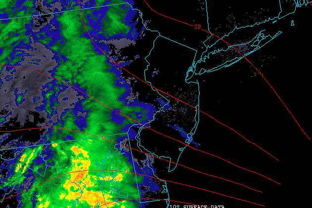
As of this writing, the leading bands of snow are knocking on the door of western New Jersey. Just like our last two hits of wintry weather, this storm system will carry warmer air into the Garden State - so it's not going to snow all day. Obviously, as temperatures spike above that magical 32-degree mark, any snow will quickly changeover to a cold rain.
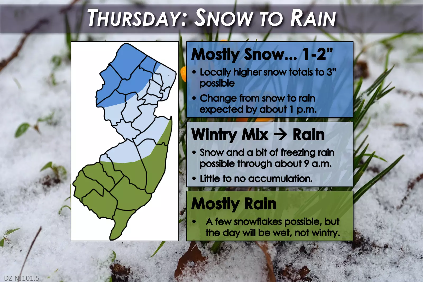
As our latest forecast map shows, we can split the state into three to break down the impacts of this system:
--South Jersey & Jersey Shore: There may be a few snowflakes, especially in the early morning hours. But above-freezing temperatures will keep this storm's precipitation mostly rain here. Rainfall totals will probably end up in the quarter-inch to half-inch range.
--Central Jersey & NE NJ: All snow will transition to a snow-rain mix, before going all rain by late morning. A trace of snow may accumulate on cold, grassy surfaces before the transition. Models suggest a bit of freezing rain is possible along the I-78 corridor around Hunterdon and Somerset counties - that could make driving hazardous for a brief time.
--NW NJ: Snow may fall here for several hours Thursday morning, before changing to rain by early afternoon. Accumulations will be limited to an inch or two - I could see an isolated 3" snowfall total around Sussex County.
Most snow-mix-rain will occur between 7 a.m. and 4 p.m. Thursday, with residual showers potentially continuing through about 7 p.m.
No warnings, watches, or advisories have been issued for this minor round of wintry weather.
Behind the precipitation will come a cold front, which will clear the skies and introduce a gusty wind starting Thursday night. Wind gusts to 30 mph will make the night especially blustery. Overnight lows are forecast to fall into the upper 20s to lower 30s. But that doesn't tell the entire story - the wind chill ("feels like" temperature) will probably dip into the teens for much of the state.
Winds stay up on Friday. Skies will range from mostly cloudy in North Jersey to partly sunny in Central Jersey to mostly sunny in South Jersey. A few snow showers will be possible, potentially reducing visibility for a brief time. Highs will be seasonable in the lower 40s, but the wind chill will probably be stuck in the 30s (at best) all day.
The New Year's weekend looks mostly quiet, albeit chilly. Saturday (New Year's Eve) will bring increasing clouds, with high temps holding steady in the lower 40s.
As we close out 2016 and ring in 2017 late Saturday night into early Sunday morning, there may be a few snowflakes flying around as a weak disturbance clips New Jersey. A bit of a breeze will add a bite to the cold December-January air. Temperatures at midnight will be in the 30s, but wind chills will be in the 20s.
For Sunday (New Year's Day), skies will remain mostly cloudy with highs climbing into the mid 40s.
The long-range forecast for the first week of 2017 shows a distinct warming trend for Monday and Tuesday, as our next storm system slides through. This will be a sizable system, with a prolonged period of precipitation from Monday morning through Tuesday afternoon. But with temperatures climbing from the 40s to near 60 degrees, this one looks like all rain.
More From 94.3 The Point


