Traffic, power, closings: Keep updated on NJ snowstorm
The bad news: New Jersey is getting a wintry blast of snow and cold temperatures coming off the long Thanksgiving weekend.
Sunday saw the arrival of icy conditions and some snow in the northern part of the state, while much of the rest of NJ dealt with rain or sleet, according to Chief Meteorologist Dan Zarrow.
The biggest snow accumulations are yet to come Monday, as this storm system strengthens dramatically just off the coast, Zarrow said.
A Winter Storm Warning continued Sunday evening for western Bergen, Morris, Passaic Sussex, and Warren counties, while also including Hunterdon, Mercer, and Somerset counties.
A less-urgent, less-severe Winter Weather Advisory was in place for eastern Bergen, Essex, Middlesex, and Union counties. That also was expanded by Sunday evening to include Burlington, Camden, Gloucester, Hudson, Monmouth, and Ocean counties.
A Coastal Flood Advisory was in effect for Middlesex, Monmouth, and Ocean counties, where a foot of surge may cause minor flooding during Monday's midday high tide cycle.
Monday was looking snowier than originally anticipated, Zarrow said, with a possibility for isolated double-digit totals in North Jersey and some late Monday snow accumulation in South Jersey. Zarrow said by the time this storm winds down, it appears snow accumulation is possible anywhere in New Jersey by Tuesday morning.
The good news: We're here to help you through it, with instant alerts on our app, on 943thepoint.com and on social media.

Here's what you'll need to know all day long:
SEND US YOUR SNOW PICS: Shoot them over via the 94.3ThePoint app for Android or iOS, and we may use them on 943thepoint.com. Open the menu on the left and hit "Submit Photo/Video."
SCHOOL AND OTHER CLOSINGS: Announcements are updated in real-time on the app. Are you a school official or the point person for an organization? You can register your district at the link as well.
WEATHER: Keep an eye on Dan Zarrow's blog on the app. Unlike some weather forecasters, Dan's not about to hype news he's not sure of. He'll tell you what he knows, what he does't, and why — there's no better way to keep on top of the storm as it develops.
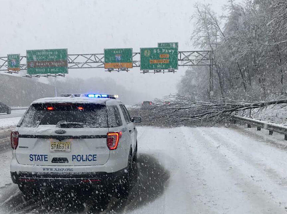
TRAFFIC AND ROADS: The New Jersey Department of Transportation issues alerts through 511nj.org.
ON THE RADIO, OUR APP & ALEXA: Listen to 94.3ThePoint anytime on air, online or on your phone by downloading the 94.3ThePoint app. (In addition to weather and news updates, we'll be playing music all weekend). We're also on Amazon Alexa, both as a 24/7 stream and as Flash Briefings updated several times every day.
SOCIAL: Follow 94.3ThePoint on Twitter, Facebook and Instagram. Message us with questions and what you're experiencing where you are. We'd love to see your pictures of the snow!
MASS TRANSIT: NJ Transit issues advisories at NJTransit.com and on Twitter @NJTransit.
POWER: PSE&G customers: See PSE&G's power map for outages and report downed trees, gas leaks, other emergencies or outages to 800-436-PSEG. JCP&L customers: See JCP&L's map for outages. Call in issues to 888-LIGHTSS or report your outage online. Atlantic City Electric customers: See Atlantic City Electric's map or call 800-833-7476 for any issues.
STATE EMERGENCY ALERTS: The state Office of Emergency Management issues alerts on Facebook and Twitter.
COMMUNITY ALERTS: Many New Jersey towns use the Nixle system to send alerts. Many others use Everbridge. Check those services and your municipal website, for more information. Several municipalities, schools and police departments also post frequently to their own Facebook pages and Twitter accounts.
USING A GENERATOR? Here's how to keep safe. Carbon monoxide poisoning caused five New Jersey deaths in the aftermath of superstorm Sandy — we don't want to be reporting on any after this storm.
More from the Jersey Shore:
More From 94.3 The Point