Bitter cold, arctic wind, and snow showers return to NJ
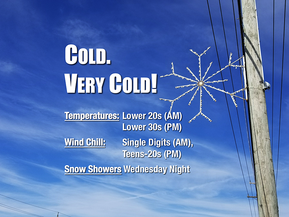
Wind chills are in the single digits Wednesday morning. Snow showers and light accumulations in the forecast for Wednesday night.

Sunny. Dry. Windy. And cold. Very cold.
There's your forecast for Wednesday. Indeed, arctic air has returned to the Garden State, leading to some of the coldest temperatures of the season so far. All week so far, I've asserted these temperatures would be ridiculously frigid, even in the dead of winter. Still true — let's look at the numbers.
The "dead of winter" occurs, on average, between January 16 and January 18 in New Jersey — the coldest days of the year with normal high temps between 38 and 41 degrees, and normal low temps around 24 degrees.
At both Newark and Atlantic City airports, Wednesday morning's low temperature will be about 21 degrees with a forecast high temperature of just 33 or 34. Definitely below normal for mid-December. And yes, a few degrees below normal for mid-January too. Add in the wind chill, and it's going to feel like single digits in the morning, only improving to the teens and 20s by the afternoon. Not quite "dangerous cold," but it will be quite a shock to the system if you don't dress warmly.
The wind will be so fierce, with occasional gusts over 40 mph, that the National Weather Service popped out a Wind Advisory for Atlantic, Cape May, and Cumberland counties in South Jersey. Garbage cans and holiday decorations may get blown down the streets, downed tree limbs may cause sporadic power outages, and driving may be difficult (especially in high-profile vehicles like vans and trucks).
Needless to say, it is a big "bundle up" day. All day.
As the wind dies down a bit Wednesday night, a storm system will slide from west to east across New Jersey. A period of light snow is expected for most of the state between about 10 p.m. Wednesday and 8 a.m. Thursday. It will certainly be cold enough for snow, with lows in the lower to mid 20s. But don't expect much — this storm system is definitely on the weak side, and our air is very dry. Only minor accumulations are forecast:
--Up to an inch in far northwest NJ
--Up to a half-inch for the rest of central and northern NJ
--A coating for southern and coastal NJ
Thursday will start with clouds, with increasing sunshine taking over by midday. It will remain breezy and cold, with highs in the mid to upper 30s.
Friday might become the coldest day of the week, with teens and 20s in the morning and lower 30s in the afternoon. Expect mostly cloudy skies and light winds. (Thankfully no brutal wind chill to deal with.) A few snow showers may put a fresh dusting on the ground on Friday, especially late-day.
I had been watching a potentially complicated and snowy setup for the start of the weekend. However, models are now falling on a solution that phases this system too far off-shore to bring precipitation to New Jersey. So I'll call this weekend snow-free and probably mostly sunny.
Saturday will be another blustery and cold day, with highs barely reaching 40 degrees — below normal for the fourth day in a row. Thermometer improvements are in line for Sunday, with seasonable mid 40s in the forecast. More mild weather (40s and 50s) are expected through early next week.
Dan Zarrow is Chief Meteorologist for Townsquare Media New Jersey. Follow him on Facebook or Twitter for the latest forecast and realtime weather updates.
More From 94.3 The Point


