
Still hot for most of Friday – cooldown and possible storms later
A cold front will deliver cooler, drier air to New Jersey starting Friday afternoon, along with a chance for spot showers and thunderstorms.

On Thursday, Mother Nature smashed Newark's record high temperature as the thermometer rose to 94 degrees. The heat continues for most of Friday, but big changes are ahead just in time for the weekend.
For this edition of the weather blog, I want to try something a little different. I was chatting with someone yesterday about my method of "interrogating the forecast" - in other words, guiding my daily weather analysis by asking important questions and researching the answers. (Basically following the scientific method we all learned about in elementary school.)
So I'm structuring this post in a similar fashion, giving you a behind-the-scenes look of how I build your New Jersey weather forecast. Hopefully the layout of this post helps you understand the latest forecast and why I wrote it this way. Hopefully. Let me know what you think!
First step, the recent past... What's been going on this week?
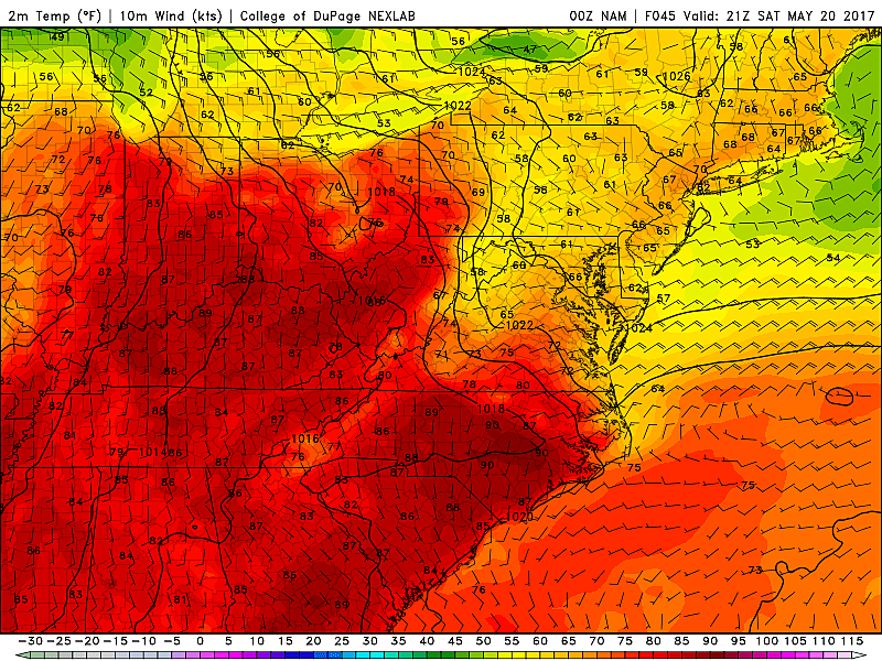
The past two days have featured record-breaking temperatures, mostly in the 90s. That's an impressive 20 degrees above normal for mid-May. High humidity, poor air quality, and high pollen levels have made the hot weather even more unbearable.
My high temperature forecast for Thursday was 93 at Newark, 92 at Trenton, and 90 at Atlantic City. I was within a degree at each climate site, with actual highs of 94 at Newark, 92 at Trenton, and 91 at Atlantic City. Good! That means my thinking and the forecast models seem to be handling the magnitude of the heat very well.
Second step, right now... What's going on?
Due to continued high humidity, Friday morning temperatures are once again in the 70s. Gross. Meanwhile, scattered clouds have filtered into the skies of Jersey overnight. Thursday night's showers and storms stayed north of New Jersey, so the radar remains clear.
Broad overview of what's coming?
Looking specifically at the forecast models for the upper levels of the atmosphere, it's clear that a big change is coming. The dome of high pressure that provided the hot, humid weather is pushing further and further off the Atlantic coast. That will allow a cold front — the leading edge of a cooler, drier air mass — to push through New Jersey on Friday, leading to a big cooldown for the weekend.
Timing of the cold front?
The latest models have pushed the arrival of Friday's front a bit later, starting in the northwest corner of New Jersey around 3 p.m. This leading edge of the cooler air will sweep southeastward across the Garden State through Friday evening.
Effect on temperatures?
The later timing means thermometers will have a few extra hours to warm, leading to Friday's high temperatures ending up a few degrees warmer (well, hotter) than I've been thinking.
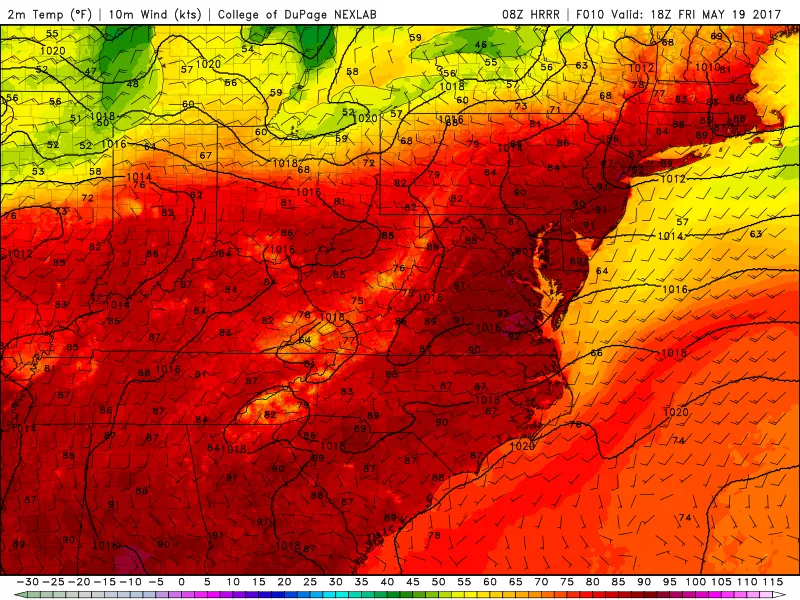
It seems prudent to bump most of New Jersey into the 90s for yet another day. The cool spot will be NW NJ, which will only make it to the mid 80s before the cold front, wind shift, and ensuing cooldown. The Jersey Shore will probably end up a few degrees cooler as well, especially on barrier islands. (Microscale forecasting of the sea breeze is exceptionally difficult, but I do have data from the past two days of heat to guide my new forecast.)
The hot spot will be inland southern New Jersey, the last to see the impending front. We may reach the mid 90s in isolated locales before the cooldown begins.
How quickly will temps drop?
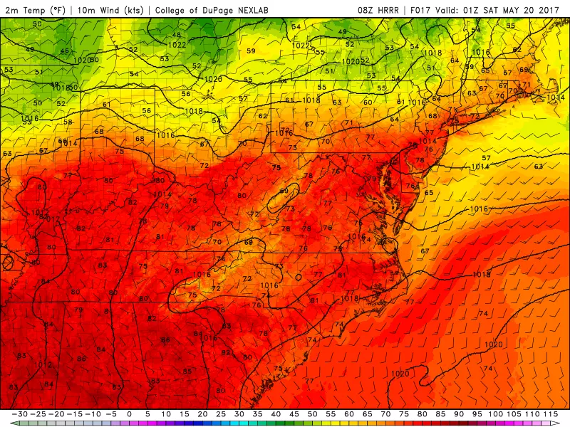
As the front passes by, you'll notice it immediately as winds flip to a northerly wind direction. Humidity will drop quickly, and temperatures will start to decrease as well. It looks like thermometers will drop about 15 degrees in the 3 hours after frontal passage.
Precipitation?
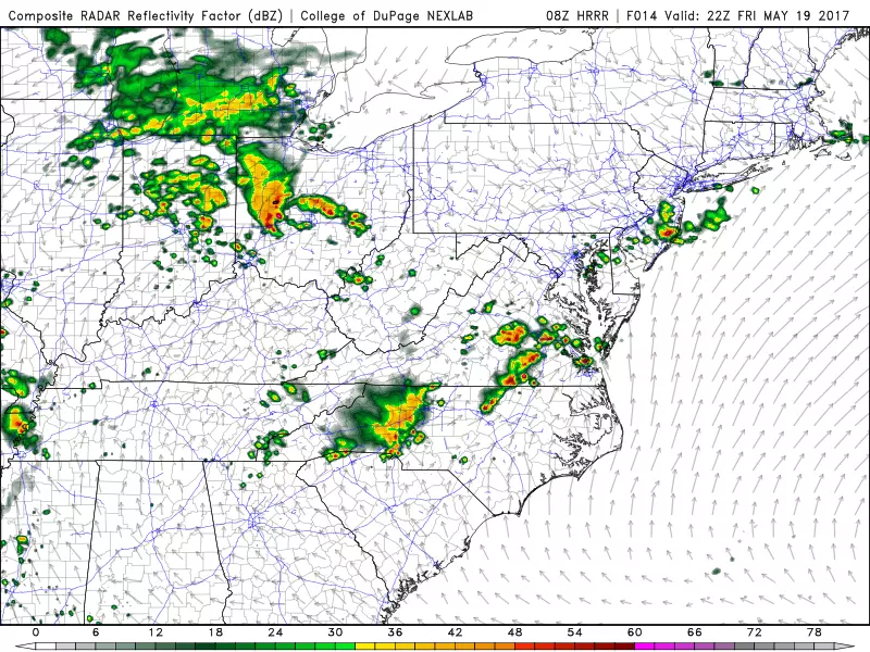
Usually a cold front means rain. (And/or snow in the winter, of course.) In this case, the front is rather "shallow" — while we're talking about a significant cooldown, the boundary between hot and cool isn't as sharp as it could be. This will lead to limited lift, therefore limiting our rain chances.
Having said that, it appears the dynamics will be favorable in South Jersey for some rain, and possible a couple of stronger storms.
Mode of rain?
I spend a lot of time each day deciding on the exact wording of my on-air forecast. In this case, I have to describe the limited (not guaranteed) threat for storms in southern New Jersey precisely and accurately. Chance of widely scattered showers? Strong thunderstorms likely? It might rain, it might not? Run for the hill?
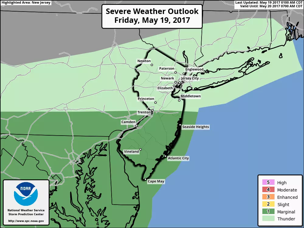
Ultimately, I decided on: "A few spot thunderstorms are possible, mainly in South Jersey." The word "spot" references the isolated or widely scattered nature of any rain that does develop. The word "thunderstorms" reflects on the chance for thunder and lightning along with some rain. (Remember, by definition, every thunderstorm contains lightning. Therefore, by definition, every thunderstorm is potentially dangerous.) The word "possible" shows my confidence is shaky, and that the rain isn't guaranteed in any given location. And while I mention "South Jersey" as the target for potential raindrops, I don't limit the chance to that area of the state by using the word "mainly".
Overnight conditions
Even though our air gets drier, I have to include a few clouds in the forecast for Friday night, as a result of decaying convection (i.e. showers and thunderstorms that fell apart). Any brisk northerly wind should slowly calm down overnight. Since it's going to be a cool wind, after a trio of hot days, I can break the word "refreshing" out of the weather toolbox.
Precision forecasting just after a frontal passage is difficult, so I have to give a big range of potential temperatures overnight. North Jersey may touch upper 40s. Eh, I'll call it 50 degrees. South Jersey may not fall below the lower 60s. Eh, call it about 60. So, overnight lows will fall to the 50s. Refreshing!
Day 2... Definitely cooler... But just how cool?
After a period of cool winds blowing from the north, it looks like we'll shift to easterly and then southeasterly. Hmmm, that's decent news for inland New Jersey, hopefully allowing for temps to climb to about the upper 60s. But as the wind blows off the relatively cool ocean, the coast might end up uncomfortably cooler and cloudier, in the lower 60s or so at best.
So, not a terrible day with temps just below normal for mid-to-late May, especially since we'll stay dry throughout the weekend. Skies will average partly sunny ‐ breaks of sunshine will be more evident the further north and west you are.
Difference between Saturday and Sunday?
The subtle on-shore flow will continue Saturday night and Sunday. I think that justifies a slightly cooler and cloudier forecast statewide on Sunday. High temperatures will be limited to the lower to mid 60s. Again, not bad. But 70s would be better.
Next big weather maker?
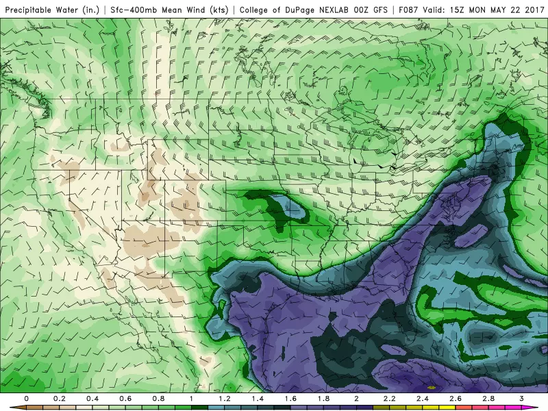
Another front looks to approach on Monday, and this one will tap into a strong "river of moisture" directly from the Gulf of Mexico. Plenty of moisture means plenty of rain.
Models suggest an inch or two of total rainfall. Maybe a washout? But there might be breaks in the rainfall action, so it's too early to say.
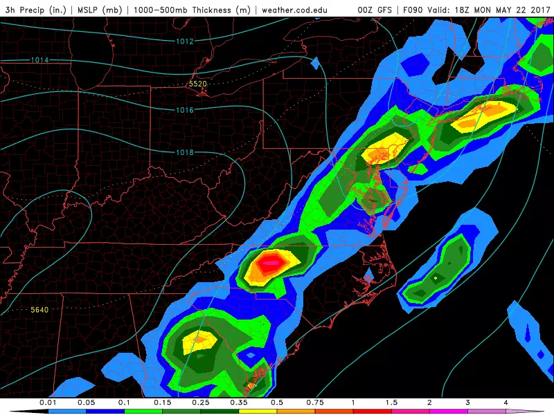
Furthermore, with temperatures returning to the 70s, there will probably be enough energy to sustain thunderstorms. Maybe strong to severe thunderstorms. I'll have to monitor the risks of lightning and wind through the weekend, so I can nail down that forecast by Monday morning.
The long-range forecast?
As you may know, my on-air forecast only goes out 4 time periods — Today, Tonight, Tomorrow, and Sunday during the day, transitioning to Tonight, Tomorrow, Sunday, Monday later on. Tuesday will appear in my online 5-Day Forecast. Anything beyond that, I don't need details, just a broad sense of what may be coming down the 'pike. Especially since the Memorial Day Weekend is right around the corner.
Tuesday looks nice. A mix of sun and clouds, with temperatures bumping just above normal, into the mid 70s.
For now, models show Wednesday daytime stays quiet, holding onto 70s. Clouds will increase as another storm system complex comes into view. If I had to make a call now, I'd say Wednesday night and Thursday morning would be wet. But at 96 to 120 hours away, it's too early for exact details. Maybe worth a mention of midweek unsettled weather if I have an extra couple of seconds on the radio.
So how about that Memorial Day Weekend?
I know some of my colleagues have already begun "going out on a limb" with a 8-10 day forecast for the holiday weekend. I know my forecast skill is absolute garbage at that time frame, so specifics are out of the question.
Based on model trends, I'm comfortable giving some broad statements about next weekend. I don't see a big storm system being a problem. I don't see another huge warmup, so temperatures should end up close to normal (within 10 degrees in either direction, perhaps). At the moment, Saturday looks pleasant, but Sunday looks unsettled. But not only "might" that forecast change, it "will" change, so take with a huge grain of salt.
Heading Down the Shore?
That's a question directed at you!
With the start of the Memorial Day Weekend just a week away, it's time to fire up our new and improved Get to the Beach Report for the Jersey Shore. Updated daily through September 30th, my goal is provide you a one-stop-shop for all the weather and surf information you need for a trip to the beach. Check it out and bookmark it for your coastal road trips this summer!
Have a great weekend!
Dan Zarrow is Chief Meteorologist for Townsquare Media New Jersey. Follow him on Facebook or Twitter for the latest forecast and realtime weather updates.
More From 94.3 The Point


