Back to spring weather, NJ: Cooler, more comfortable, somewhat unsettled
The Bottom Line
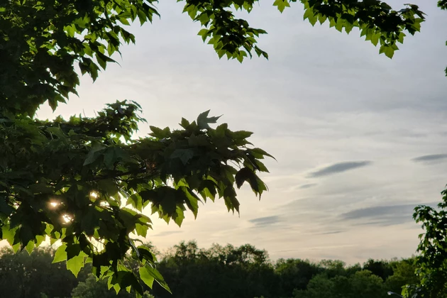
First of all, as I type out this article early Monday morning, I am marveling at how bright it is outside. Sunrise is almost as early as 5:37 a.m. now, with sunset approaching 8:30 p.m. in the coming weeks. A sign that summer truly is on the horizon.
Of course, we had another sign of summer this weekend — heat and humidity! Both Saturday and Sunday featured inland 90s, broken records, and a lot of sweaty New Jerseyans.
Now, cooler, drier air will yield more comfortable weather. Our weather forecast turns somewhat unsettled too, as temperatures remain at or below normal for the next four days. There will be clouds and an on-shore breeze too. Rain chances will be limited.
Our next big weathermaker will be a cold front driving in thunderstorms on Friday. Obviously, all eyes are on the big Memorial Day Weekend coming up. The progression of that front — the speed, and what comes after — will directly dictate how the holiday weekend's weather will fare.
Monday
The sun is rising on a pretty pleasant late May day. Temperatures on this Monday morning have fallen to around 60. Dew points have dipped to around 50. It is breezy, out of the north up to 20 mph. A refreshing, cooler, more comfortable start to the day.
High temperatures should settle around 70 to 75 degrees. Close to normal for this time of year. (Certainly much closer than this weekend's steamy conditions.) We'll start with nice bright skies — I'll call it partly sunny. And then becoming mostly cloudy through the afternoon. The breeze goes away. And we'll stay dry during the daytime hours.
A weak impulse will ride in from the west starting Monday evening. That means we're going to get wet — although nothing crazy this time around. Scattered light rain is likely between about 7 p.m. Monday and 7 a.m. Tuesday. Most rain totals should end up less than a tenth of an inch.
Overnight lows will be seasonably cool, in the mid 50s or so.
Tuesday
The rain showers from overnight may linger for a bit on Tuesday. Possible as late as midday. Especially in southern New Jersey.
Having said that, I'm leaning toward mainly dry weather for Tuesday. There will be a batch of rain stalled over the southeastern U.S. But a dome of high pressure to our north will hopefully keep those raindrops away from NJ's southern border.
So for Tuesday, we'll eventually see a mix of clouds and sun, with a light southeasterly wind. The big story will be the temperature. We'll only reach highs in the mid 60s, running about 10 degrees below normal for late May.
Not quite jacket weather. But we are definitely putting away the shorts and sandals for a bit.
Wednesday
Wednesday could be the coolest day of the week. Lower 50s in the morning may have you reaching for a light jacket. And then only lower to mid 60s in the afternoon. Granted, we were craving those temperatures a month ago. But here in May, it's typically much warmer.
At least Wednesday will look like a nice day, with partly sunny skies, a light on-shore breeze, and dry weather.
Thursday
The stalled disturbance to our south will unhinge itself on Thursday, potentially pushing a batch of spotty rain showers through New Jersey.
Even if we stay dry, Thursday will be mostly cloudy and still on the cool side. Once more, highs will only reach the 60s.
Friday & Memorial Day Weekend
I know it's early in the week, but I've had so many people already asking about the big Memorial Day Weekend forecast.
Friday will be a tricky day of transition. First of all, warmth and humidity will surge back in — we could see highs close to 80 degrees.
And then a cold front will drive in a round of strong thunderstorms. The timing of that frontal boundary is still uncertain, but afternoon or evening seems most likely.
Scenario (and potential issue) #1 for the holiday weekend would be that front and that rain lingering through the first half of Saturday. The GFS does show a wet start to Saturday. Although it's important to note that all forecast models show clearing skies and 70s by Saturday afternoon, turning into a nice late spring day.
Scenario (and potential issue) #2 is what happens next to temperatures. If the front does not stall in our neighborhood (i.e. no rain hanging into Saturday), there will be an opportunity for heat to build again early next week. The Euro model favors a return to 90s in the Sunday-Monday time frame.
Still lots of forecast puzzle pieces to fit in. Obviously, we'll keep you updated as the week rolls on.
Dan Zarrow is Chief Meteorologist for Townsquare Media New Jersey. Follow him on Facebook or Twitter for the latest forecast and realtime weather updates.
A little slice of Jersey (and U.S.) history: A look at Cowtown Rodeo
POP QUIZ: Can you name all 10 interstate highways in New Jersey?
More From 94.3 The Point


