
Friday NJ weather: Watching two storm systems between now and Thanksgiving
The Bottom Line
Our latest cold snap is officially over. We'll find ourselves in a pleasant slice of the atmosphere for both Friday and Saturday, with temperatures firmly above-normal for mid-late November. However, we are tracking two storm systems over the next week: one from Sunday to Monday, and the next in the Wednesday-Thursday time frame. The Thanksgiving forecast is trending wetter.
Friday
We're starting the day with NJ temperatures mainly in the 40s. Having said that, areas northwest of the Route 1 corridor have crashed into the 30s. But no matter where you are, temperatures are not nearly as cold as they were Thursday morning. In some places, the difference is as big as 30 degrees — that's a huge warmup!
It's a sign of what's to come — a couple of days of mild, dry, pleasant weather. Although there are some clouds and sporadic snow showers traveling through northern New Jersey early on Friday, sunshine should win the sky overall. With fair-weather clouds, dry weather, and a southwest breeze, high temperatures should soar to about 60 degrees. Back to above-normal.
Friday night will be quiet and dry too. Most of the state will only dip into the mid 40s, with a frost/freeze only expected in the coldest corners.
Saturday
A great start to the weekend. Partly sunny and lower 60s. That is all.
Sunday
A very different story. As a cold front slowly approaches from the west, we'll start the day with increased cloud cover. And then you might need the umbrella and/or windshield wipers later on, as spotty to isolated rain showers become possible starting in the early afternoon hours. As a result of the grey and the damp, high temperatures will come down to the mid 50s.
Monday
A batch of steadier light rain is forecast for early Monday morning, coming to a quick end as our frontal boundary finally arrives. That will mark the beginning of another cooldown.
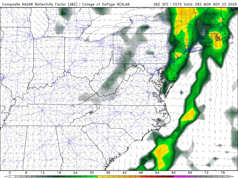
Monday's high temperature will technically reach the mid 50s again, but that will be around mid-morning. Temperatures will tumble through Monday afternoon, thanks to a brisk northwesterly breeze. At the moment, I'm estimating top wind gusts to be around 30 mph — blustery, but not necessarily hazardous.
Tuesday & Beyond
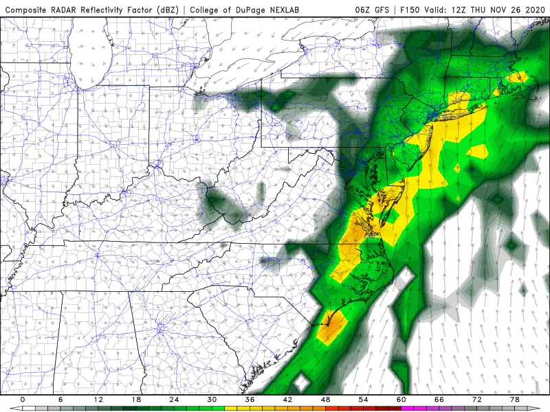
We flip back to the cold side on Tuesday, with below-normal high temps in the mid-upper 40s. While we climb back to the 50s (or even 60-ish) on Wednesday and Thursday, we'll see another storm system push into New Jersey. The timeline of the impending rain is still hazy here. Of course, Thursday is Thanksgiving Day, adding some extra importance to this outlook.
Our latest forecast favors wet weather from late Wednesday through (at least) the first half of Thursday. Some models are painting up to an inch of rainfall — healthy, and possibly heavy at times. This may impact travel and any outdoor Thanksgiving plans. We'll keep a close eye on how this forecast continues to evolve, and so should you.
To be clear: we're looking at wet, not wintry weather for Thanksgiving. I'm still not seeing a substantial snowy or icy setup through the end of November. (Thanks in large part to the continuation of generally mild, above-normal temperatures.)
Have a great weekend!
Dan Zarrow is Chief Meteorologist for Townsquare Media New Jersey. Follow him on Facebook or Twitter for the latest forecast and realtime weather updates.
The 10 Best Sunrises in Seaside Park
More From 94.3 The Point


