
Ignore the ‘snow hype’ for next storm system – mainly rain for NJ
New Jersey's biggest weather story through the rest of the week will be a storm system on Friday, set to bring some uncomfortably cool rain showers. Yes, there could be some snowflakes mixed in. No, big accumulations are unlikely. (More on that in a sec...)
The Short-Term Forecast
A pretty strong cold front passed through New Jersey Tuesday night, driving a round of strong thunderstorms and gusty winds across the state. We're now on the cooler, drier side of that front — but that's not saying much. Wednesday morning's temperatures are in the 40s, and we'll reach the lower to mid 50s Wednesday afternoon. Cooler than the past few days, but still 5 to 10 degrees above seasonal normals.
Wednesday will be windy, with gusts between 20 and 30 mph throughout the day. But the day also looks sunny and dry (during the daytime hours, at least).
A weak impulse riding through our atmosphere will bring a round of rain showers Wednesday evening. Nothing heavy and rather short-duration. Beyond that, Wednesday night will feature clearing skies and chilly temperatures bottoming out in the mid 30s.
Another "not bad" kind of day Thursday, with morning sun, afternoon clouds, and highs around 50 degrees. A late-day rain shower may bubble up from the south starting late Thursday afternoon.
The Friday Forecast
This is a two-pronged setup. As one storm system passes south and east of New Jersey, another will approach from the west. Close to a nor'easter structure — but the phasing between part 1 and part 2 is off. That means it will be a weaker storm over land, therefore leading to weaker impacts here in New Jersey.
Forecast models have been rather deceiving this week, with raw output painting an extended period of snow over New Jersey. But it just looks too warm for it to be a wintry day.
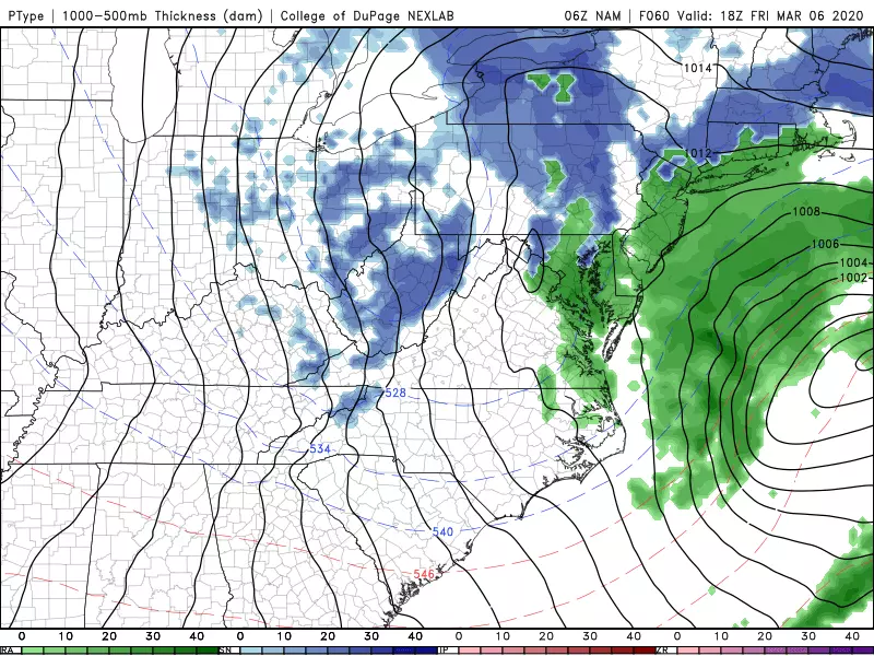
Having said that, Friday looks rather unpleasant at times, thanks to a combination of scattered rain, a stiff breeze, and cool temperatures. Thermometers will only reach the mid 40s — certainly not warm, but probably warm enough to avoid an overly wintry setup. There could be some light snow or wintry mix in NW NJ starting Friday afternoon. And, as temperatures drop Friday night, that rain-snow line looks to drift southward putting more and more of New Jersey in the snow zone.
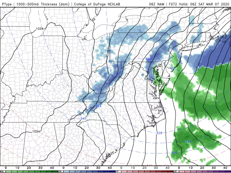
However, the intensity of the precipitation, limited time frame for snowflakes, and dubious air and ground temperatures will severely limit any potential for snow and ice accumulation. I admit there is an outside chance for an inch of snow/slush in North Jersey. But that's it — a major storm this is not.
Winds from this system won't be that fierce, but coastal flooding is another concern. Initial runs of surge models are showing about a foot of extra water along the Jersey Shore. That's enough to cause minor flooding of tidal waterways during high tide Friday Saturday.
The Long-Range Forecast
Looking ahead, the weekend forecast looks great, as bright sunshine combines with dry weather and dry air. Saturday will remain a bit cool, with highs in the lower to mid 40s. Another big warmup arrives Sunday, as temps soar into the upper 50s.
It looks like that warm weather will sustain through early next week, with highs near 60 for Monday and Tuesday. Our next storm system and chance of rain will arrive sometime on Tuesday too.
15 days until Spring! Have a great Wednesday!
Dan Zarrow is Chief Meteorologist for Townsquare Media New Jersey. Follow him on Facebook or Twitter for the latest forecast and realtime weather updates.
More From 94.3 The Point


