New Jersey begins October with two days of warm, summery weather
I've decided to call this a "whiplash" weather forecast. Near 80 Tuesday. 90 Wednesday. 60s for Thursday and beyond. With some (much-needed) soaking rain along the way. Let's dig in to the details...
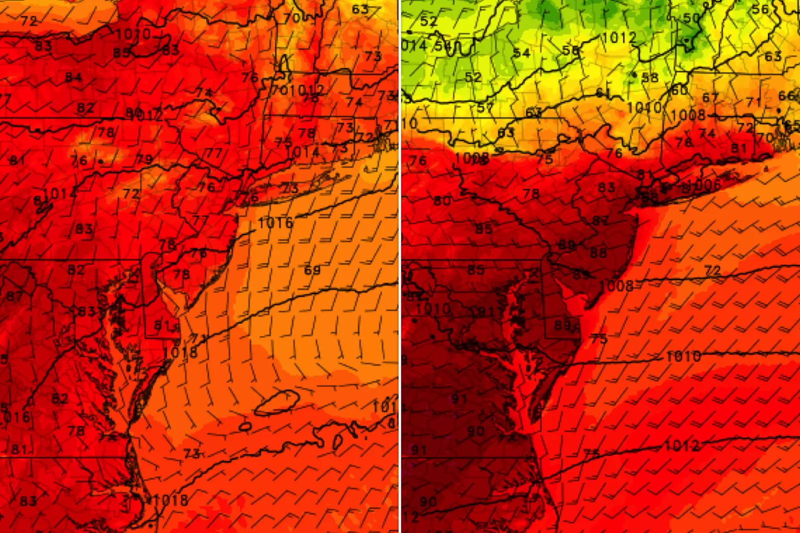
Tuesday morning isn't all that cool, with temperatures around the 60-degree mark — you can probably skip a jacket. Morning clouds will give way to plentiful sunshine by Tuesday afternoon. It will be a dry weather day, and warmer than Monday. Look for highs around 75 to 80 degrees. That is 5 to 10 degrees above-normal for early October.
Along the Jersey Shore, a high risk of rip currents continues. Ocean waves will average about 3 to 4 feet Tuesday. (Note: Our Jersey Shore Report has ended regular updates for the 2019 season. But I'll continue to provide surf updates in my daily weather blog, as appropriate.)
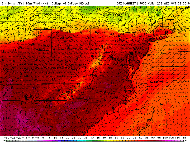
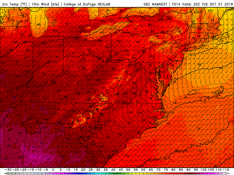
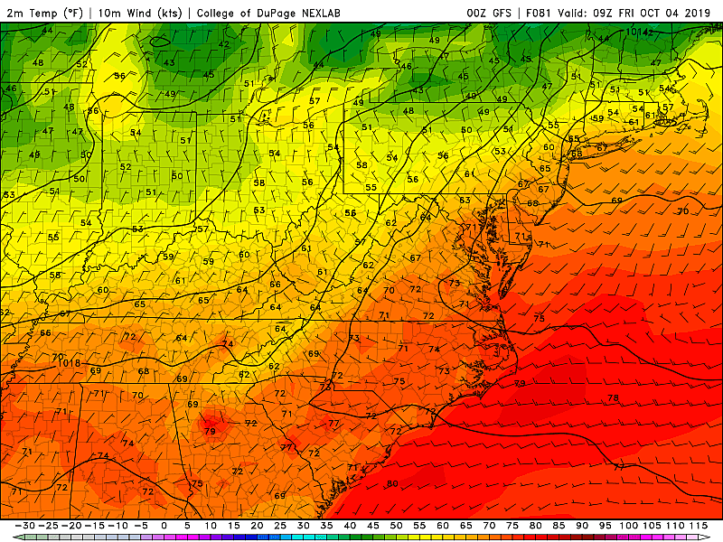
High-res NAM temperature forecast for Wednesday, showing widespread 80s across New Jersey but much cooler air just to the north. (College of DuPage Meteorology)[/caption]
Record high temperatures for October 2 are:
—86 at EWR (Newark/Elizabeth), last set in 2013
—85 at TTN (Trenton/Ewing), set in 2002
—85 at ACY (Atlantic City/Egg Harbor Township), last set in 2013
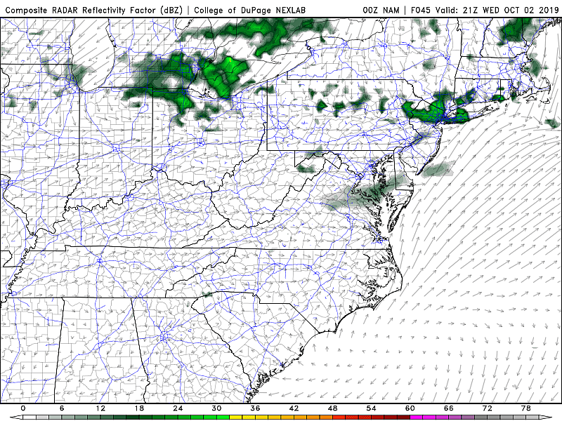
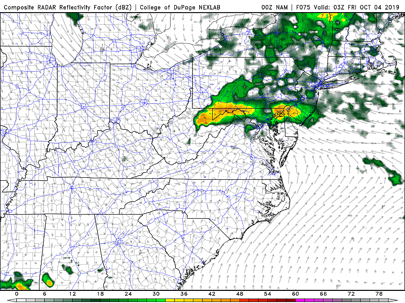
Skies will progress from sun to clouds on Wednesday, as our big cold front approaches from the northwest. Eventually that front will put an end to the warming and bring us some rain.
Forecast model consensus puts our first raindrops over NW NJ Wednesday mid-afternoon, with scattered showers and thunderstorms sliding southward into South Jersey through Wednesday evening. By about 1 a.m. Thursday morning, all sectors of the state should be tasting wet weather.
Thursday will be a very different weather day. First of all, it looks pretty wet, with periods of rain likely all day (especially for northern and central New Jersey). In addition, the day looks cloudy, breezy, and much cooler. No more 90s nonsense — highs on Thursday afternoon will be limited to about 65 to 70 degrees.
Final raindrops and clouds will exit the Garden State Friday morning. And then we'll have a sunny and blustery day to end the work week. Northwesterly wind gusts may blow as hard as 35 mph, likely causing temperatures to hold steady or drop throughout the day. Even so, I doubt we'll see thermometers get out of the 60s at best on Friday.
As our weather settles down this weekend, you'll get a pleasant but definitively fall-like day for Saturday. More reminiscent of late October than early October, perhaps, mornings lows may dip into the 30s in North Jersey. Meanwhile, high temperatures on Saturday will get stuck in the lower to mid 60s. Skies will remain sunny and winds will be light.
On Sunday, high temps pop closer to the seasonable 70-degree mark. Our weather turns mostly cloudy, and guidance does show the weekend will end with some rain showers.
Both the GFS and Euro show those showers intensifying into steady, heavy rain late Monday into Tuesday. Two solid rain chances over the next week? Definitely good news. Hopefully those raindrops hit all the right spots, helping our mounting drought situation.
Dan Zarrow is Chief Meteorologist for Townsquare Media New Jersey. Follow him on Facebook or Twitter for the latest forecast and realtime weather updates.
More From 94.3 The Point


