
NJ storm update: Thursday we get soaked, Friday we freeze
UPDATE... This article is outdated...
For the latest winter storm forecast information, please refer to my newest weather blog post.
The Bottom Line
Mother Nature is going on the "naughty" list this year. A powerful storm system will impact New Jersey through one of the busiest travel periods of the year, leading up to Christmas. It is NOT a "snow storm" — but this will be a multiple high impact event. From rain and wind, to a brief hit of snow, to an arctic blast causing a flash freeze, to potential coastal flooding. This is going to be a nasty one. There will be significant travel headaches across New Jersey and beyond.
Thursday, it's all about rain and wind. Friday, our attention turns to the arctic blast and flash freeze. This weekend, ridiculous, dangerous cold.
Thursday Morning
Quiet weather so far. We are starting the day with temperatures mainly in the 20s. (My fingers and face hurt just thinking about how the current temps are warmer than we'll get all weekend long.)
Showers will bubble up from the south Thursday morning. Light, scattered stuff so far. There is a chance temperatures are cold enough to sustain a brief period of wintry mix, especially along the western edge of NJ. But I am not worried about accumulations or travel impacts.
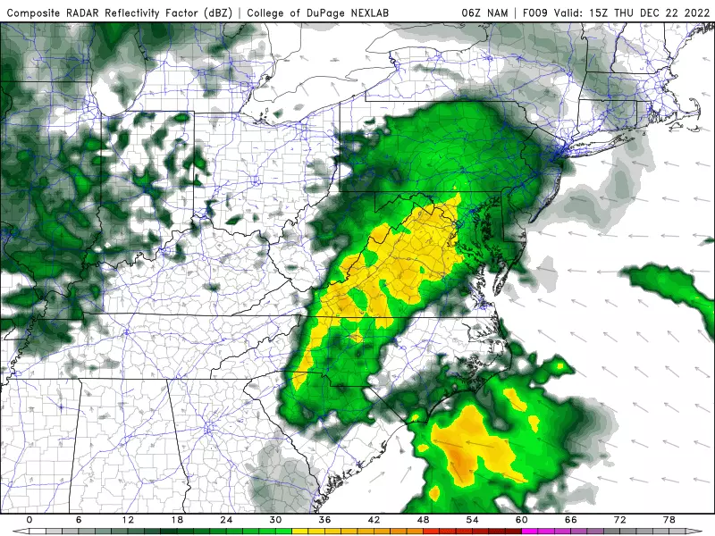
Thursday Afternoon
As the day goes on, rainfall will become steadier and more widespread. Temperatures will warm into the 40s.
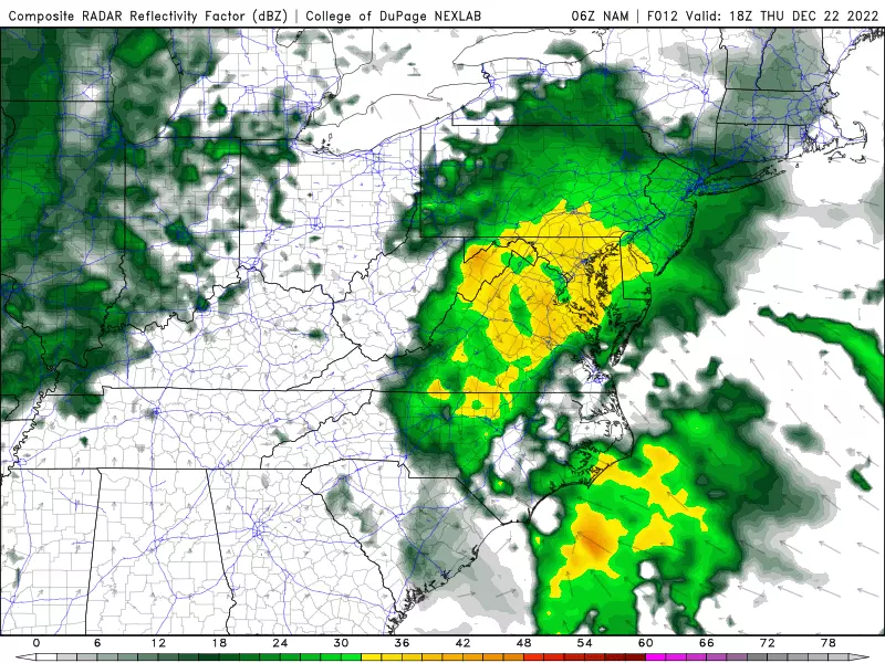
Thursday Night
The brunt of the storm. Heavy rain will combine with gusty winds, on the order of 40 to 50 mph through early Friday morning. It's going to be downright nasty, as that wind-driven rain causes visibility and traction problems. Meanwhile temperatures will rise well into the 50s.
A Flood Watch is in effect for most of New Jersey from 1 p.m. Thursday through 7 a.m. Friday. Ponding and big puddles are especially a concern where leaves are blocking storm drains.
One more mounting problem late night will be coastal flooding. We're still looking at 2 feet of water rise along the Jersey Shore for the high tide cycle beginning early Friday morning. A Coastal Flood Warning cautions of moderate category flooding along the Middlesex and Monmouth county shorelines. A Coastal Flood Advisory calls for minor flooding farther south.
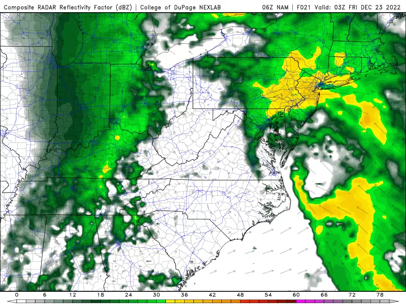
Friday Morning
Rainfall intensity should largely let up by about 4 or 5 a.m., with a welcome lull lasting through the morning rush hour. Temperatures will probably fall back into the 40s at this point — but again, still above freezing.
One more push of rain and snow is likely between about 8 a.m. and 2 p.m. Friday. Yes, I said snow — as colder air works in (at all levels of the atmosphere), a quick flip to snow is possible. That band of snow could even become squall-ish (heavy). If so, I wouldn't rule out a coating on colder surfaces in NW NJ.
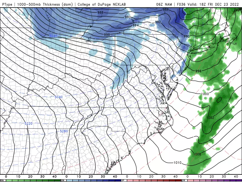
Friday Midday
This will be the most precarious part of the forecast. Arctic air will push in from the west starting around 10 a.m. to 1 p.m. And temperatures will begin to plummet. We'll drop 30 to 40 degrees within just a few hours.
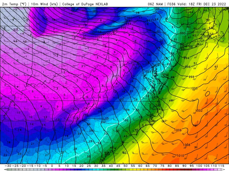
Most importantly, by early afternoon, thermometers will fall below the freezing mark. That means all the puddles and wet surfaces from the earlier rainfall are susceptible to rapidly ice over. We call that a "flash freeze".
And unfortunately, this is a "perfect storm" setup for widespread icing issues due to that flash freeze Friday afternoon. Crews will not be able to pre-treat roadways in advance of the storm, due to the rainy forecast. I really hope everyone pays attention and adjusts travel plans accordingly, so we avoid the worst-case scenario — big highway pile-ups.
Friday Night
Temperatures just keep on dropping. We'll fall into the 20s by sunset. And then near-record single digits and teens overnight.
Plus, the wind will continue to howl, possibly gusting to 30 or 40 mph overnight. That puts the wind chill as low as 10-below by Saturday morning. Bitter cold. Downright dangerous cold. You have to protect yourself if you'll be out in the elements.

Saturday (Christmas Eve)
The extreme cold situation is not going to improve much. High temperatures on Saturday will only reach about 20 degrees. It will remain breezy to windy, keeping the wind chill close to zero. Skies will become mostly sunny, and your Christmas Eve will be bone-dry.
Sunday (Christmas Day)
Still frigid. Again, teens in the morning. And mid 20s in the afternoon. Winds will come down a bit, but I think it'll still be a breezy day. Once again, dry air will allow for bright sunshine.
The Extended Forecast
A slow warmup will thankfully kick in for the last week of the year. We should pop to the freezing mark on Monday, and then above-freezing upper 30s on Tuesday. More seasonable 40s are a possibility for the second half of the week.
Next opportunity for a storm system would be around New Year's Eve. We're probably just looking at rain, if anything.
Dan Zarrow is Chief Meteorologist for Townsquare Media New Jersey. Follow him on Facebook or Twitter for the latest forecast and realtime weather updates.
Let it snow: 12 things to know about winter forecasting in NJ
Gallery Credit: Dan Zarrow
Christmas snow - When it's happened, and the 2024 odds for NJ
Gallery Credit: Mike Brant
Light Up New Jersey: Best holiday displays of 2022
Gallery Credit: Light Up NJ — Vote here
More From 94.3 The Point


