
NJ weather: Rain lingers all day Tuesday, then turning very cold
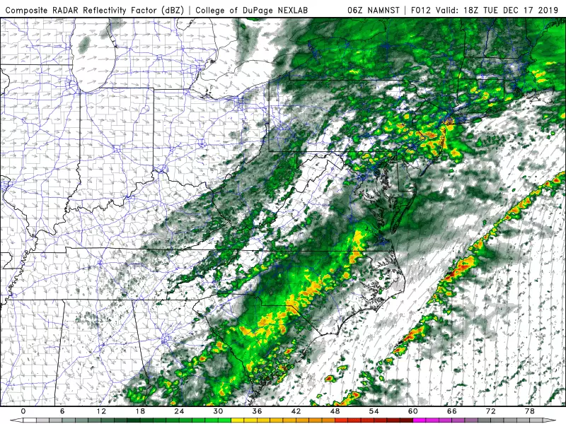
We saw snow. We saw sleet. We saw rain. Mother Nature has thrown a lot of precipitation at New Jersey over the past 24 hours. But we were spared the ominous worst-case scenario. Yes, there will be slippery spots early Tuesday, but thankfully it is not widespread and not severe. (In fact, pockets of flooding due to heavy rain have presented bigger problems overnight.)
This storm system isn't done yet. In fact, we have a long way to go until it kicks out to sea and precipitation tapers off.
Periods of light to moderate rain will pass through New Jersey throughout Tuesday morning and afternoon. You might even hear a few rumbles of thunder along the way, especially in the warm sector in South Jersey and along the coast.
There is still a risk of wintry mix and icing in North Jersey. However, as (relatively) warm air bubbles up from the south Tuesday, the risk for wintry weather will be more and more unlikely.
Watch for an unusally wide high temperature range across the Garden State Tuesday afternoon. We'll end up near 30 degrees in far North Jersey, around 40 degrees through inland Central Jersey, close to 50 degrees along the Jersey Shore, and potentially near 60 degrees in far South Jersey.
Rain will finally exit Tuesday evening, between about 5 p.m. and 9 p.m. Behind the wet weather, skies will clear quickly. A brisk northwesterly breeze will kick up too. Low temperatures will dip into the upper 20s to lower 30s. Most of the state will freeze Tuesday night, so watch out for black ice Wednesday morning from the refreeze.
You will feel a wintry chill in the air Wednesday. Despite sunshine, high temperatures will get stuck in the upper 30s for most — that is about 5 degrees below-normal for mid-December. A few uneventful snow showers are possible Wednesday afternoon. The wind will really get kicking late-day Wednesday, with potential gusts to 30-40 mph.
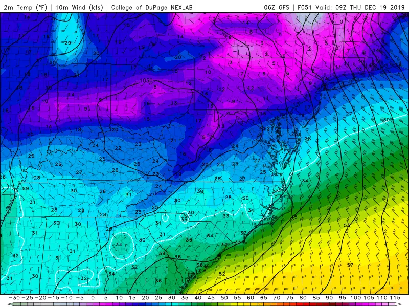
Thermometers will bottom out Thursday, and it is going to be painfully bitter! Thursday morning lows will end up in the teens, with widespread wind chills between about 0 and 5 degrees. Thursday afternoon highs will only reach the upper 20s for most. Even in the dead of winter, that would be a frigid day. At least it will be dry and sunny.
Friday will be slightly warmer, with highs bumping into the mid to upper 30s under increasing clouds.
At present, there are no storm systems in the forecast through Christmas Day, next Wednesday. I wouldn't put that quiet forecast in ink just yet. But the calm stretch of weather will be a nice departure from the past week, which has been crazy busy around here!
Dan Zarrow is Chief Meteorologist for Townsquare Media New Jersey. Follow him on Facebook or Twitter for the latest forecast and realtime weather updates. `
More From 94.3 The Point


