NJ weather: This week starts warm, but will end 20 degrees cooler
The Bottom Line
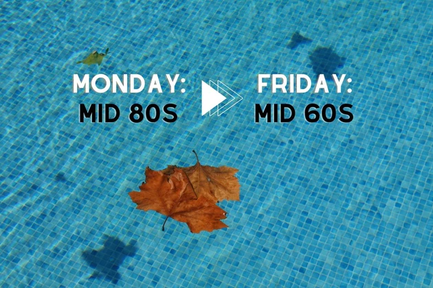
The official start of fall — the Autumnal Equinox — is coming up on Thursday at 9:04 p.m. And how appropriate, since Thursday will be a big transition day for New Jersey. We start the week warm and summer-ish, with highs in the 80s. But by Friday, it will turn almost 20 degrees colder. I'm afraid "shorts and flip flops" weather is about to come to an end. (For now.)
Along the way, we have two rain chances to talk about, 1.) late Monday and then 2.) late Wednesday to early Thursday.. Lacking deep moisture or rich instability, we are not looking at widespread flooding or severe weather. Just scattered rain, perhaps with some rumbles of thunder.
Monday
Monday's temperatures will be very similar to Sunday's, if not a degree or two warmer. (Monday will probably be the warmest day of the week.)
We're starting the day in the comfortable 60s. And highs will reach the warm, summer-ish mid 80s. Morning sun will transition to afternoon clouds.
A weak cold front will push into northwestern New Jersey starting around mid-afternoon. So there is a chance of rain Monday. Glorious news, given our moderate to severe drought condition. Best chance of wet weather will be from about 3 p.m. to 9 p.m.
We do not have particularly rich moisture or deep instability in play. So I do not expect widespread flooding or severe weather. There could be some rumbles of thunder. And maybe even some outflow winds on the order of 40 mph. (Especially in NW NJ.)
It's just a batch of wet weather, not a good soaking. Rainfall totals will range from zilch to a quarter- or half-inch.
Once late Monday evening rolls around, our weather will dry out. With partly cloudy skies overnight, it will stay pretty mild. Thermometers will only bottom out in the mid 60s Tuesday morning.
Tuesday
Tuesday will be cooler than Monday. But only slightly.
I've put forecast highs around 80 degrees. It will be mostly sunny, with a refreshing northwest breeze up to 20 mph. Humidity and dew points will tick downward too. All in all, a pleasant September, late summer day.
Wednesday
The daytime hours on Wednesday also look good. Periods of sun and clouds should once again allow temperatures to come close to 80 degrees. The air might feel a bit stickier by the afternoon.
And then, we'll be closely watching the approach of a strong cold front. The GFS model shows a Wednesday evening arrival, with a period of rain lasting into Thursday morning. The Euro model, however, pushes that boundary into NJ much later — during the daytime hours on Thursday. Total rainfall will average about a half-inch.
Thursday
Thursday's weather will depend largely on the timing of that aforementioned frontal boundary. I probably favor the earlier solution at this point, keeping most of the rain in Thursday's pre-dawn hours. That means Thursday daytime would be on the cool side of the line. Even though conditions would dry out, it would be mostly cloudy with highs only around 70.
I will mention that the later Euro solution would be not only wetter during the day Thursday, but also warmer. If rain doesn't start until lunchtime in South Jersey, 80s would be a possibility.
Friday & Beyond
No matter how Thursday's uncertain transition plays out, we'll have a real taste of fall weather for the first full day of autumn on Friday.
Morning lows in the 40s. Afternoon highs in the mid 60s. Bright sunshine, bone dry air, and a strong northwest breeze. It might make you ready for pumpkin spice and/or trick-or-treating.
Temperatures will slowly moderate as we head into the final weekend of September. Saturday's high of 70 degrees is still more reminiscent of October. A return of southwesterly winds could bring a return of 80 degrees on Sunday into next week.
Dan Zarrow is Chief Meteorologist for Townsquare Media New Jersey. Follow him on Facebook or Twitter for the latest forecast and realtime weather updates.
Top Songs of the Summer of Love
The Best Stromboli In New Jersey...or anywhere
More From 94.3 The Point


