NJ’s 4th winter storm in a week: Rain, freezing rain, light icing
Monday was a "South Jersey special" foot-plus snow storm. Wednesday turned into a freezing rain mess, with widespread icing to the north. Friday's storm system put down a few inches of fresh powder statewide.
And here we are, staring down another burst of wintry weather this weekend. Our fourth in less than seven days.
This is another ice-not-snow event. And winter weather is not a concern for the entire state. Especially since this storm system will eventually transition to plain rain. However, there could be a few hours of travel disruptions on Sunday due to slick conditions.
Let's run through what to expect this weekend. And about the deep freeze in the forecast for next week too.
Saturday: No Problems
We're starting off the weekend with some cold temperatures. Widespread teens have led to a hard freeze overnight — anything liquid will have frozen solid. So bundle up, and watch your step.
Highs on Saturday will struggle to reach past the freezing mark (lower 30s). It will be bright and sunny, which will help snowmelt (especially on blacktop surfaces). Winds will be light, and our air/weather will stay completely dry.
Sunday: The Bottom Line
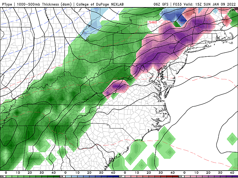
A slow-moving cold front will slide from west to east across New Jersey on Sunday, driving an extended period of precipitation.
That precipitation will fall mainly as rain, with temperatures bumping into the 40s Sunday afternoon.
However, at onset Sunday morning, the atmosphere's temperature profile will be conducive to some icy mix. Maybe some snowflakes and sleet pellets. But the big concern is for freezing rain.
As you know, it does not take much freezing rain to cause a very icy situation. Hence, the extra attention here.
Sunday: Timeline
Sunday's first band of precipitation should crash across the Delaware River into western New Jersey between about 7 a.m. and 10 a.m. Temperatures on the early end of this window would be around 30 degrees. Certainly cold enough to sustain some wintry mix at onset, especially to the north and west.
The big concern comes between about 10 a.m. and 1 p.m., as the air warms into the mid-upper 30s, but the ground does not. Freezing rain is our worst-case scenario during this time frame, which could lead to light icing.
By the afternoon, temperatures across most of the state will bump into the 40s, well above freezing. So for the rest of the day, into the evening, this storm system will produce just plain rain across New Jersey. The wet, liquid, non-frozen kind. Final raindrops will probably come in the late evening hours, around 10 p.m.
Sunday: Accumulation/Impacts
No snow accumulation. A tenth- to a quarter inch of rain. And a light glaze to a tenth of an inch of ice accumulation. That is the perilous part of this forecast — ice is no fun at all.
As you'd probably guess, the biggest risk for icing will be in the coldest corner of the state, Sussex and Warren counties. Model guidance does show a chance for a bit of icy mix and potentially slippery spots as far south as Mercer and Middlesex counties.
If you're not going to be on the roads Sunday, you have nothing to worry about. If travel is in your future, you might want to adjust your plans and/or leave plenty of extra time in case the worst-case scenario icing occurs.
Hopefully treated roads will fare OK here. But sidewalks, steps, and side streets could get treacherous.
Power outages also come to mind when forecasting heavy ice accumulations on trees and power lines. But it doesn't look like ice accumulations will be that severe, so I do not think blackouts will be a significant, widespread concern.
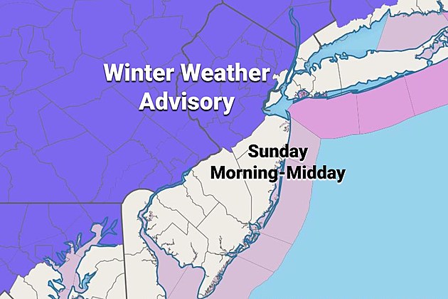
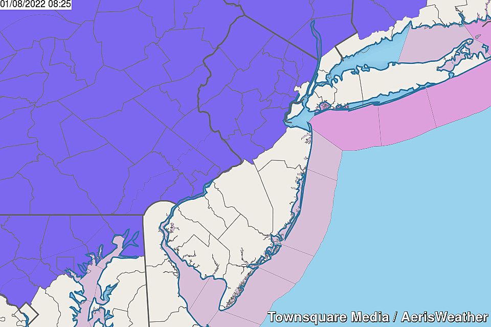
Sunday: Winter Weather Advisory
I was shocked to see how many New Jerseyans were caught totally surprised by Wednesday morning's icy mess.
In an effort to provide a nice, early heads-up of the ice risk, the National Weather Service has already issued a Winter Weather Advisory for 11 NJ counties. Here's the breakdown by counties and effective times:
—Sussex and Warren... 5 a.m. to 1 p.m. Sunday... Up to a tenth of an inch of ice accumulation.
—Western Passaic... 7 a.m. to 2 p.m. Sunday... A light glaze of ice.
—Bergen, Essex, eastern Passaic, and Union... 7 a.m. to 11 a.m. Sunday... A light glaze of ice.
—Hunterdon, Mercer, Middlesex, Morris, and Somerset... 7 a.m. to 1 p.m. Sunday... A light glaze of ice.
As we've discussed so many times in the last week, a Winter Weather Advisory is all about hazardous travel conditions. If you don't have to drive during those times, don't. If you do, be extra vigilant and extra careful.
The Extended Forecast
Beyond Sunday's storm, it's going to get cold. Very cold.
Monday's high temperatures will scale back to the lower 30s. That's already almost 10 degrees below normal for early January. (Note: We're not quite to the average coldest part of the year yet — that's late January.)
Tuesday will be the "bottom of the barrel" of this cold snap. Morning teens. Daytime highs only in the lower-mid 20s. By the numbers, it will probably be New Jersey's coldest day since February 2019 (almost three years). If/when the wind blows, the wind chill will bite, in the single digits.
Wednesday morning could bring single digit temperatures, followed by a slight improvement to daytime highs. Back to the lower 30s.
At least cold air is dry air, and the dominant storm track will shift well to our south. So amidst the chill, it will be a quiet week of weather. Our next chance for a storm system probably won't come along until next weekend.
Stay warm, be safe. Next weather blog update is expected Sunday morning.
Dan Zarrow is Chief Meteorologist for Townsquare Media New Jersey. Follow him on Facebook or Twitter for the latest forecast and realtime weather updates.
New Jersey's smallest towns by population
Gallery Credit: Michael Symons
New Jersey's new congressional districts for the 2020s
Gallery Credit: Michael Symons
More From 94.3 The Point


