
NJ’s next 3 storm systems: Weekend rain showers, possible snow next week
The Before: Fantastic Friday
We are now in the middle of Hanukkah, with only two weeks to go until Christmas, heading into another December weekend. And with an active forecast to talk about here, your Friday weather is looking very good across New Jersey.
Definitely a cold start to the day, with widespread 20s away from the coast. And, with some very localized patchy fog, there is a slight concern for freezing fog. That's when it's cold enough for fog droplets to adhere to surfaces as ice. I don't think it's going to be a big, bad, widespread problem (we had a Freezing Fog Advisory that was cancelled early). But I suppose there could be some black ice and slippery spots, especially on elevated surfaces like bridges and overpasses. (You know those Bridge Surface Freezes Before Roadway signs? This is one instance when they might be relevant.)
The rest of the day will feature mostly to partly sunny skies — cloud cover will slowly increase as the day goes along. It will be dry and mild, with high temperatures in the lower to mid 50s. That is about 10 degrees above normal for mid-December. And for parts of the state, it could be our warmest day of December so far.
As our atmosphere moistens up, dense fog seems a good bet for Friday night through Saturday morning. Skies will become mostly cloudy. Both of those factors will prevent temperatures from falling below the mid 40s.
Storm System #1: Rain Showers This Weekend
This weekend's storm system is two-pronged: a warm front, followed by a cold front. Nothing too dramatic, but it will be dreary and damp at times. Neither weekend day will be a total washout or total loss.
On Saturday, that warm front will cause high temperatures to bubble into the 55 to 60 degree range for the southern two-thirds of New Jersey. (Closer to 50 degrees to the north.) The concurrent increase in moisture will also keep fog and clouds around, in addition to fueling patchy drizzle and spotty showers. It looks like the best chance for raindrops Saturday will be 1.) in the morning, and 2.) along the coast. But that is not exclusive.
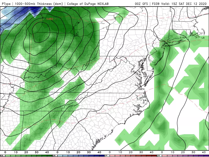
One more round of rain showers is likely early Sunday morning (pre-dawn), as the main storm system passes to our north. And then the rest of Sunday looks fine — breezy, with breaks of sun. Although cooler air is on the way, we should still see high temperatures around 55 to 60 degrees midday Sunday. Thermometers may start to slip backwards by the middle of the afternoon.
Storm System #2: Clipped from the South
Highs on Monday will return to the seasonably chilly mid 40s, as we return to the cold side of the world. A storm system is forecast to pass south of New Jersey. And it looks like a few showers could clip NJ around midday Monday. Given the track and timing (temperatures in the 40s), that should be rain rather than snow. And the favored forecast limits those raindrops to the southern half of New Jersey — although I wouldn't rule out a northward "wiggle", putting more of NJ under precipitation during the day Monday.
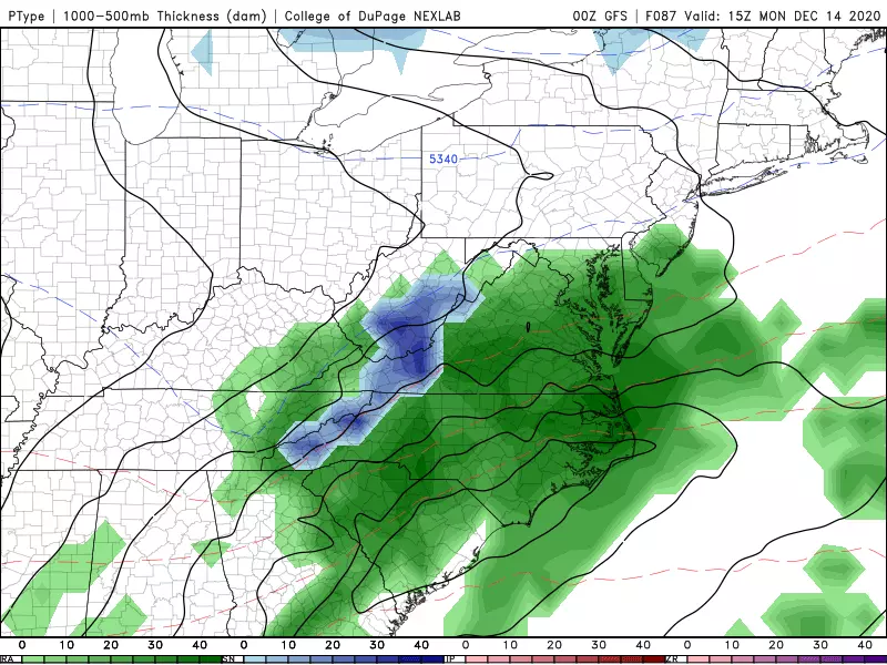
There is one model — the Euro — that paints a significantly farther north and even colder trend for Monday. Basically, it shows precipitation across New Jersey, including snow for the northern half of the state. It is a far departure from the other long-range models. But sometimes the outlier turns out to be right — so it's worth keeping an eye on the potential for snowflakes throughout the weekend.
Tuesday looks good, although cold. Partly sunny with highs only in the lower 40s.
Storm System #3: Snow/Rain Next Week?
Looking down the road, model guidance is picking up on a storm system around Wednesday of next week. And I have to admit — even though it's still five days away, this could be New Jersey's best shot at widespread accumulating snow since November 2018 (#Brinegate).
It's a "Miller Type B Nor'easter" setup. A primary (weak) area of low pressure to the west assists a secondary coastal low strengthen dramatically. Such storms are generally not our biggest blizzard-makers (that's the "Type A" nor'easter). But it still could drive a lot of snow, rain, wind, and surge toward New Jersey.
As of this morning, all major medium-range forecast models and their associated ensembles are showing at least partial impacts for New Jersey around the middle of next week. I'm not ready to officially bang the gavel and call it a definite "hit" (or "miss") yet — but we'll be looking to do that as Wednesday enters the 5 Day Forecast this weekend.
The major challenge here will be temperatures, which are largely driven by the exact storm track. Snow to the north and west. Rain to the south and east. Where to draw that freezing line, and how/when will it drift during the storm? Who the heck knows at this point.
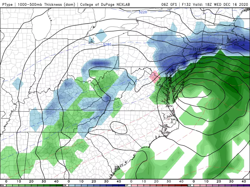
In terms of potential snow accumulation? Given the latest forecast picture, I think there's a good chance of 6+ inches of snow in New Jersey. (Some models even go 12+ inches!) But there's also a legitimate chance that part of New Jersey sees only rain. (For the record, I currently favor the operational GFS and ensemble Euro snow solution. Operational Euro shows a weird bubble of warmth. UKMAT is warm, but reasonable. The Canadian is just backwards.)
There are still 120 hours to go until first snowflakes and raindrops — that's an eternity in the world of weather forecasting. So where do we go from here? I pull back on the reins, and ask you to remain cautious and patient. With a few more model runs under our belt — by Saturday morning — we'll be able to make a hit or miss call. If warranted, we'll start looking at more specific timing, impacts, and accumulations starting Sunday evening or Monday morning. (If you see me publish a special weather blog this weekend, you know which way this forecast is trending!)
Dan Zarrow is Chief Meteorologist for Townsquare Media New Jersey. Follow him on Facebook or Twitter for the latest forecast and realtime weather updates.
The 10 Best Sunrises in Seaside Park
More From 94.3 The Point


