Snow (and rain) showers will visit NJ Wednesday, a coating possible
The Bottom Line
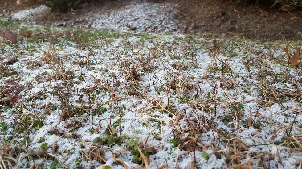
Oh yes, it is going to feel and look wintry across New Jersey today, with a chill in the air and probably some snowflakes too. Light accumulations are possible — but don't expect much.
The rest of the workweek will feature quiet, warming weather. Our next storm system will drive in rain showers this weekend.

Wednesday
New Jersey will be at the edge of a storm system passing to our north. Parts of Upstate New York could see upwards of 6 inches of snow Wednesday. Here in the Garden State, there are a ton of limiting factors inhibiting our potential snow showers. Will it be cold enough? Will there be enough moisture in the atmosphere? Are we just too far south of the storm system?
The timing of these showers has drifted later since we last spoke on Tuesday. Most models now paint precipitation between Wednesday late morning and early evening — let's call it 10 a.m. to 6 p.m. Based on that timeline, the temperature forecast, and geography, I think the best chance for snow showers will be alone and west of the Route 1 corridor. South and east of that, the snow vs. rain situation gets more complicated.
I still think a dusting (trace) to coating (less than a half-inch) of snow is a good bet for part of the state by the end of the day. I'll even go as far as including the northern half of the state in that "potentially wintry zone". (That's along and north of Interstate 195.)
In a perfect setup — meaning it's cold enough, moist enough, and the storm is close enough — there could be some slippery spots and brief pockets of reduced visibility. In a not-perfect setup, snow showers will fizzle to rain showers and/or nothing.
Otherwise, it will be a mostly cloudy and cold December day. For the third day in a row, thermometers will struggle to reach the 40 degree mark.
Skies will clear Wednesday night, as lows dip into the lower 30s. (In the back of my mind, I'm wondering if temperatures could crash even further into the 20s overnight, if skies clear faster than expected.)
Thursday
Bright and sunny. And slightly warmer too. Highs will push into the upper 40s.
Friday
Hey, lower 50s isn't too shabby for early December. Morning sunshine, then increasing clouds. Another dry and reasonably nice day.
Saturday
The weekend will bring our next storm system, as slow moving cold front. Most of the impacts will be felt on Sunday. But as humidity ramps up slightly Saturday, I could see an isolated shower or two.
Skies Saturday will be mostly cloudy, with temperatures will push well into the 50s. (60+ is a possibility in South Jersey.) So if you can dodge raindrops, Saturday's forecast looks pretty good.
Sunday & Beyond
As the aforementioned cold front sweeps toward the state, we face several rounds of showers. All rain, all light. High temperatures will be very similar to Saturday, around 55 to 60 degrees.
As the raindrops wrap up, a brisk wind will usher in colder air again for early next week. Temps on Monday and Tuesday will get knocked back to the seasonal mid 40s. Remember, that cold air means any successive storm system could produce some snow/ice. (The Euro model paints a chance of wintry stuff on Tuesday, but it is all alone in that outlook at the moment.)
Dan Zarrow is Chief Meteorologist for Townsquare Media New Jersey. Follow him on Facebook or Twitter for the latest forecast and realtime weather updates.
August 19th Monmouth County Tornado Damage
More From 94.3 The Point


