
Stormy end to July – gusty winds and flooding possible Wednesday
SEVERE THUNDERSTORM WARNING for NE Burlington, SE Mercer, SW Monmouth and NW Ocean counties until 3:15 p.m. Severe storms were located along a line extending from Imlaystown to near Browns Mills, moving east at 25 mph with 60 mph wind gusts and penny size hail.
SEVERE THUNDERSTORM WATCH in effect for the entire state until 9 p.m.
SEVERE THUNDERSTORM WARNING in effect for NW Burlington, NW Camden, SW Mercer and north central Gloucester counties until 2:15 p.m. for a severe storm located over Philadelphia moving east at 15 mph with 60 mph winds.
SEVERE THUNDERSTORM WARNING for NW Camden and NW Burlington counties until 1:30 p.m. A severe storm located northeast of Philadelphia with 60 mph winds is moving northeast at 7 mph.
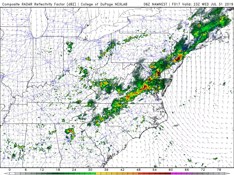
On average, July is New Jersey's wettest month of the year. And it has been especially wet this July, with precipitation running at least an inch above-normal for most spots in the state. We'll pad those totals with one more round of drenching, gusty thunderstorms on Wednesday. And, given our hot and humid atmosphere, those storms are likely to reach strong or severe limits.
Wednesday morning looks nice and quiet. Sunshine will accompany warm temps in the 70s as you step out the front door. Clouds will increase, and we might see spotty showers by lunchtime. But overall, if you're looking for some outside time or beach time Wednesday, the morning hours are your best bet.
Starting Wednesday afternoon (about 2 p.m. give or take) we'll have to keep an eye on the sky for thunderstorms popping up and rolling in, generally moving from northwest to southeast. Given the heat and humidity, it should be no surprise that these storms will pack a powerful punch.
My biggest concern here — as we've seen countless times this summer — will be heavy downpours leading to flooding. Everybody in the state will get wet, but not everyone will necessarily experience heavy rain. Models are still pumping out pockets of 2 to 3+ inches of rain. If that falls in a short period of time, even a few hours, that water could easily overcome storm drains and cause flooding and ponding issues. Unfortunately, the peak of those problems will coincide with the Wednesday evening commute.
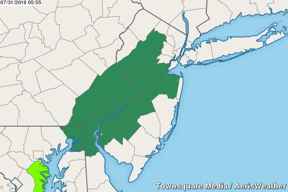
A Flash Flood Watch has been issued for northwestern Burlington, Camden, Gloucester, Hunterdon, Mercer, Middlesex, inland Monmouth, Morris, Salem, and Somerset counties, in effect from 2 p.m. to 8 p.m. Wednesday.
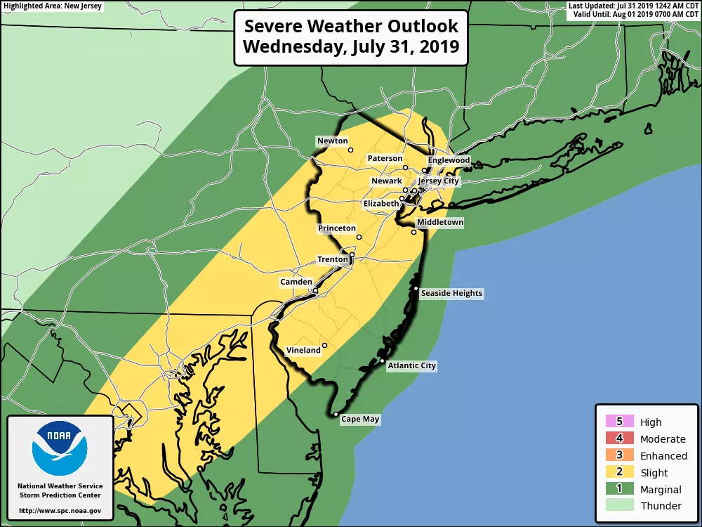
Damaging winds are also a legitimate concern from these storms, especially at onset. The Storm Prediction Center paints non-coastal New Jersey in a "Slight Risk" for severe weather. That translates to a 15% probability of 58+ mph winds within 25 miles of any point.
There will be lots of cloud-to-ground lightning during these storms too. The risk for hail and a tornado is low, but non-zero.
I've already seen a number of New Jerseyans asking if this batch of storms will be as bad as last Monday's ferocious storms that caused massive power outages and widespread road closures. It's hard to say — each storm setup is so different. Our atmosphere won't be quite as explosive this time around, but only slightly. Every thunderstorm is potentially dangerous, by definition. It's going to be very important to remain "weather aware" for the duration — stay alert to changing weather conditions, and exercise common sense regarding travel and outdoor activities.
Storms will slowly drift south, and we'll see thunderstorm intensity finally pulse down around sunset (8 p.m. give or take). We'll really start to dry out Wednesday night, after Midnight.
The end result of the stormy weather will be slightly drier and cooler conditions for Thursday. Upper 60s in the morning, mid 80s in the afternoon. Skies will be partly sunny. And our rain chance should be limited to an isolated shower or two in the southern half of New Jersey.
Friday's forecast looks better than it had been. I still have to include a smattering of a few showers and thunderstorms throughout the day, but I think a good chunk of the Garden State will remain dry. We'll see periods of sun and clouds, with high temperatures holding steady in the mid 80s.
The weekend is shaping up OK, not perfect, but not bad. I'm seeing mixed sunshine, clouds, and a few isolated showers on Saturday with highs once again in the mid 80s. Sunday is leaning hot and dry, with partly sunny skies and highs closer to 90.
We should get a taste of truly dry air on Monday, potentially setting us up for a nice start to next week.
Dan Zarrow is Chief Meteorologist for Townsquare Media New Jersey. Follow him on Facebook or Twitter for the latest forecast and realtime weather updates.
More From 94.3 The Point


