Tuesday NJ weather: A big rainy, windy transition to cooler temps
The Bottom Line
Fall cold fronts can be pretty epic here in New Jersey, driving heavy rain, a burst of wind, and a big cooldown through the state. And that's exactly our situation over the next 24 hours, as we transition from summer-ish to fall-ish weather. The nastiest conditions are expected Tuesday night through early Wednesday morning.
Tuesday
The day will start quiet and humid, but end rainy and windy. Temperatures Tuesday morning are in the 60s from top to bottom across the Garden State. And we'll top out in the lower to mid 70s — cooler than the past couple of days, but still just above seasonal norms. In addition, a little impulse to our south will spit scattered showers and thunderstorms at New Jersey throughout the daytime hours. The risk of raindrops will progressively increase as the day goes on.
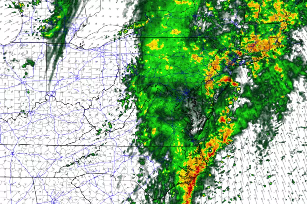
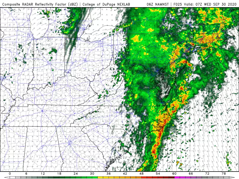
Then late Tuesday evening (let's say, around 10 a.m.), the main event begins. A period of steady, heavy rain is likely across the entire state. While model guidance is locked in to the overnight timing of this rain, there are some differences of opinion regarding the intensity and ultimate rainfall totals. I think an inch-plus of rainfall is likely for most of New Jersey. The dry ground will slurp that up easily. But if the bigtime 2 to 3 inch totals verify, there could be some flooding and ponding issues for Wednesday morning's commute.
In addition to the rain, we face a quick burst (i.e. an hour or two) of gusty winds — peaking at about 30 mph inland and 40 mph along the coast. That's the "whoosh" of our cooler, drier air arriving.
Wednesday
By the time you wake up Wednesday morning, the humidity will be completely zapped from the air. While raindrops may linger over New Jersey through about 9 a.m. Wednesday, the sun will come out shortly thereafter. It will be a breezy and cooler day, with highs limited to the upper 60s to around 70 degrees. That is slightly below normal for the last day of September. Still, a nice fall-like feel returns to the air.
Thursday
A reasonably nice start to October, with lots of sunshine in the morning. Clouds and scattered showers will arrive in the afternoon though, as a secondary cold front slowly slides through. High temps will push into the seasonable lower 70s.
Friday
The coolest day of the bunch. In fact, it will likely be New Jersey's coolest day since mid-May. Highs will only reach the lower 60s, at best. That's it! Skies will be partly sunny. And Friday should be the beginning of another extended stretch of bone-dry weather.
Saturday and Beyond
Pleasant and fall-like weather permeates the extended forecast. Mostly sunny and mid 60s Saturday. Partly sunny and mid 60s on Sunday. Mostly cloudy and mid 60s on Monday. The air might be cool and dry enough to reach the frost point in the early morning hours — but only for the coolest spots in the state.
Dan Zarrow is Chief Meteorologist for Townsquare Media New Jersey. Follow him on Facebook or Twitter for the latest forecast and realtime weather updates.
More From 94.3 The Point


