
Windy, blustery Thursday for NJ – 40+ mph gusts still possible
There is a lot to soak in regarding Wednesday's coastal storm-cold front duo. It was definitely wet, with some rainfall totals topping 2 inches. (Record daily rainfall was recorded at EWR, at 2.13 inches.) And then it got windy. (Top gust so far has been 64 mph at High Point, Sussex County.)
The rain is gone. And the absolute worst of the wind is probably behind us now. However, Thursday is going to be a windy and blustery day — gusts may be high enough to blow around garbage cans, bring down branches, cause scattered power outages, and make driving difficult.
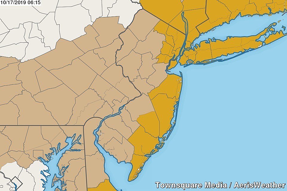
A High Wind Warning continues until 6 p.m. for five counties in northeastern New Jersey and five counties along the Jersey Shore: Atlantic, Bergen, southeastern Burlington, Cape May, Essex, Hudson, Monmouth, Ocean, Passaic, and Union. The warnings call for wind gusts as high as 60 or 65 mph. (For the record, such wind speeds aren't necessarily out of reach, but I think those estimates are a bit high.)
A less severe Wind Advisory is in effect until 6 p.m. for the rest of New Jersey, calling for gusts to 50 mph.
I'm thinking those westerly winds will be sustained at 20 to 30 mph, with occasional gusts to 40 or 50 mph throughout Thursday morning. You can probably shave about 5 to 10 mph off those numbers for Thursday afternoon.
Meanwhile, the soaking rain has departed and dry air has returned to the Garden State. However, on the backside of this storm system, clouds a few showers may drift into North Jersey at some point — south of Interstate 78, it looks like a dry and mostly sunny day.
Because of the wind, you should consider a jacket as you leave the house Thursday. Temperatures will hover close to 50 degrees early, only climbing into the upper 50s to around 60 degrees by the afternoon.
Thursday night, I think we'll still see some wind gusts around 30 mph. There will be a few clouds overhead, but not enough of a blanket to prevent temperatures from dropping into the chilly zone. I estimate lows will bottom out in the upper 40s.
I'll call Friday breezy, with wind speeds up to about 20 mph. It will be a mostly sunny and dry day, with high temperatures just below normal in the lower 60s. If you don't mind the wind, it will be a decent fall day.
Winds finally become calm to light on Saturday. Looks like a radiative cooling setup for early Saturday morning, as clear skies, calm winds, and dry air produce some cold temperatures. Upper 30s seem likely for northwestern New Jersey. (We'll see how far the frost potential may drift.) High temperatures Saturday afternoon are forecast to reach the seasonably cool lower to mid 60s.
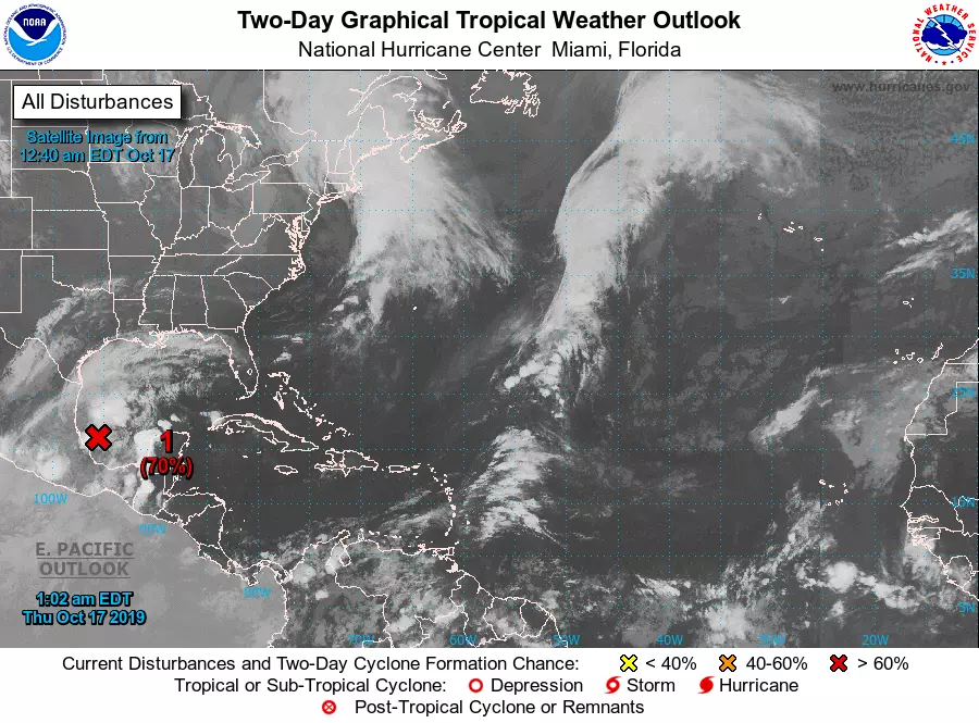
The forecast for Sunday, however, has changed. An area of low pressure is currently forming off the Gulf coast of Mexico. (This storm system is showing signs of tropical development.)
Model guidance shows that system will pass south and east of New Jersey on Sunday — certainly close enough to cause increased cloud cover, and maybe close enough to bring another blast of rain. (Wet weather is not a guarantee.) Those model forecasts are still highly volatile at this point, so I'm holding off on more detail until we gain more clarity in the next day or two.
Anything beyond the weekend is a crap shoot at the moment, as future storm tracks will be dependent on how Sunday plays out.
Dan Zarrow is Chief Meteorologist for Townsquare Media New Jersey. Follow him on Facebook or Twitter for the latest forecast and realtime weather updates.
More From 94.3 The Point


