
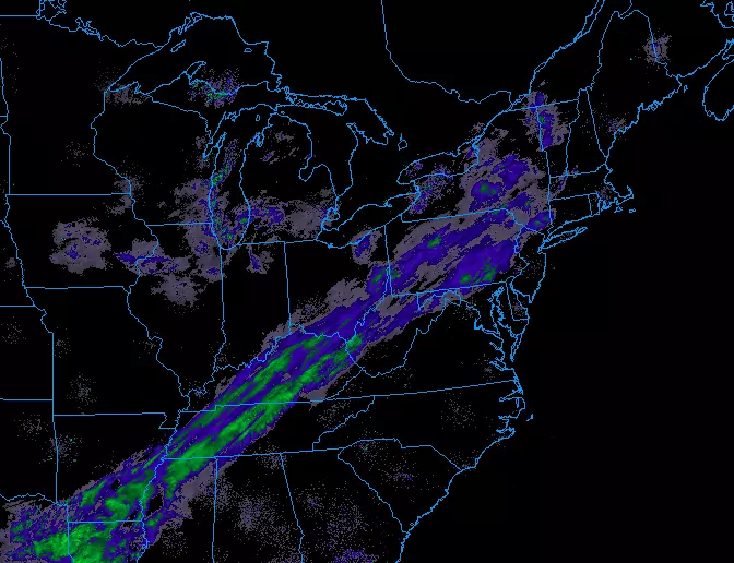
Winter Weather Advisory: Up to 6 inches of snow for North Jersey
While everyone in the Garden State will likely see some snow Tuesday into Wednesday, the wintry weather will be most significant in far northern New Jersey.

The Bottom Line
--Since my last forecast update, I have increased snow total expectations.
--Confidence is high that the heaviest snowfall will occur in far North Jersey, around Sussex and Warren counties.
--In fact, North Jersey is the only portion of the state that will experience substantial snowfall during the day Tuesday.
--Wednesday morning's commute will be the one to watch, as roads could get messy in a hurry. If a band of heavier snow sets up at that time, roads could get really messy.
--Those in South Jersey and along the Jersey Shore might be disappointed by meager snow, due to 1.) a later start, 2.) a period of mix/rain at onset, and 3.) lighter intensity snowfall.
Timeline
As of this writing, first flakes have already begun in Sussex County. But I truly mean flakes — initial snowfall is very light, and that will be the case for most of Tuesday.
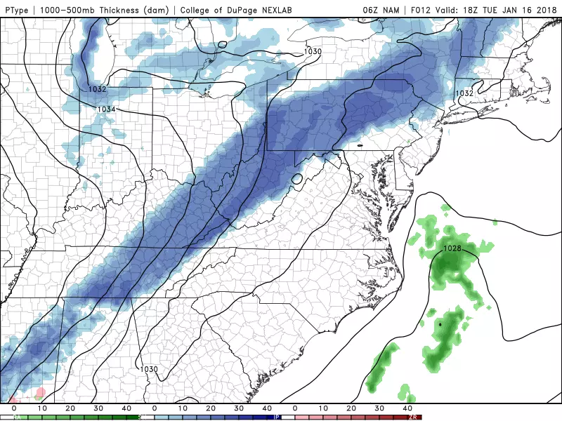
--Tuesday daytime: Snowfall geography will remain limited, as the vast majority of New Jersey stays dry and snow-free. The primary snow band will be "stuck" in the area along and north of Interstate 80 in North Jersey.
--Tuesday early evening: That snow band should unhinge itself, with snow slowly spreading through the rest of the state by sunrise Wednesday. For central and southern New Jersey, temperatures may be warm enough at onset that some mixing with rain occurs. (We'll go all snow by mid-morning Wednesday.)
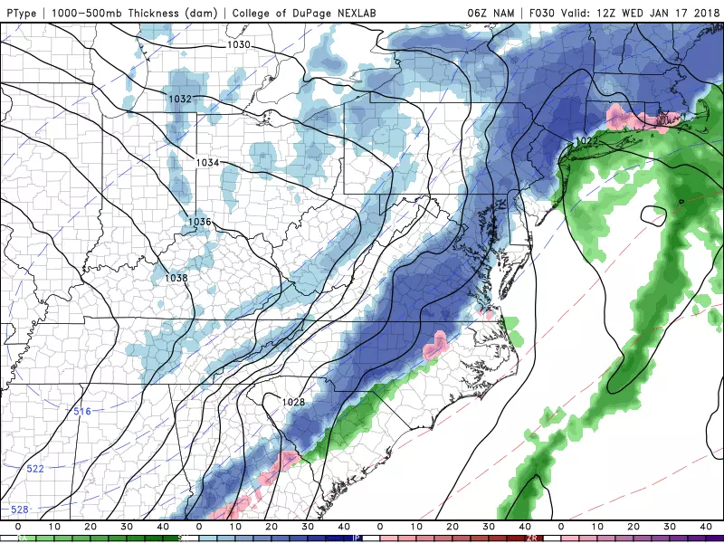
--By Wednesday morning: Snowfall intensity looks to increase, unfortunately peaking during the morning rush hour. A couple models hint at a heavier snow band over northern and central New Jersey between about 5 a.m. and 9 a.m., which could significantly reduce visibility and make road surfaces slushy and/or icy.
--Through Wednesday afternoon: Light to moderate snow will continue.
--By sunset Wednesday: Storm system should completely exit the coast.
Totals
The snowfall total forecast is tricky, especially given the chance of mixing at precipitation onset and the unknown influence of a second coastal low. Here's what we're thinking, given the latest model data. (See the map at the top of this post for a visual depiction.)
--4 to 6 inches: far northern New Jersey (Warren, Sussex, Morris, and Passaic counties).
--2 to 4 inches: south and east of that main "snow zone," stretching as far south as Middlesex and Mercer counties.
--1 to 2 inches: further south, for inland portions of central and southern New Jersey (riding down the Interstate 295 corridor).
--A slushy coating to an inch: along the coast.
Advisory

A Winter Weather Advisory has been issued for 10 counties in northern New Jersey, with revisedeffective times to match the predicted onset and end times of most significant snowfall. The differences in times and impacts are due to differing opinions between the two NWS offices that service New Jersey (Mt. Holly and Upton, NY).
--8 a.m. Tuesday to 9 a.m. Wednesday: Sussex and Warren counties.
--4 p.m. Tuesday to 9 a.m. Wednesday: Hunterdon, Morris, and Somerset counties.
--4 p.m. Tuesday to 4 p.m. Wednesday: western Bergen, western Essex, Passaic, and western Union counties.
--Midnight to 6 p.m. Wednesday: eastern Bergen, eastern Essex, Hudson, and eastern Union counties.
Remember, an advisory is not a warning — it's just a more formal "heads up" of potentially hazardous weather. In this case, it means travel conditions may deteriorate due to slippery roads and low visibility.
Ice Jam
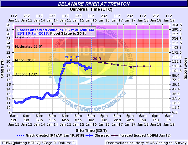
A quick update on the Delaware River ice jam near Trenton, that caused some significant flooding problems on Monday.
Water levels dropped a couple of inches overnight, even faster than forecast. The river height will continue to fluctuate a bit over time, but it is expected stay below the key 20-foot flood stage. (That's when the southbound lanes and ramps of Route 29 are prone to flooding.)
Good news all around!
What's Next?
Behind the snow will come a reinforcing shot of cold air — although it won't be the brand of frigid, arctic air to which we've become accustomed. Thursday will be sunny, breezy, and chilly with high temperatures in the mid 30s.
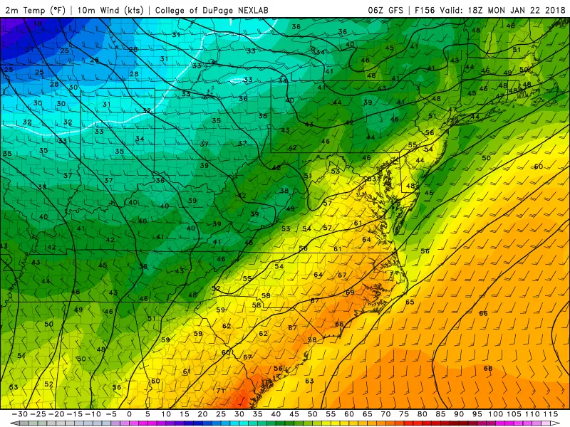
A warmup will carry us into the upcoming weekend! High temperatures should climb to a seasonable 40 degrees on Friday, mild upper 40s on Saturday, and even milder lower to mid 50s for Sunday and Monday!
Our next storm system of note is currently scheduled for late Monday to early Tuesday. With the above-freezing temperatures, this currently looks like a rain-maker, with a quick hit of snow at the end as temperatures start to drop.
Dan Zarrow is Chief Meteorologist for Townsquare Media New Jersey. Follow him on Facebook or Twitter for the latest forecast and realtime weather updates.
More From 94.3 The Point


