Chilly temperatures about to return to NJ, but only for a few days
We have a couple of changes to talk about in our forecast. But these aren't big, bad, dramatic swings. Just a shift toward cooler, drier air and a glancing blow from a storm system. By the weekend, our weather is looking pretty fantastic again!
As our latest storm system departs, showers and sprinkles will exit the southern coast by around 9 a.m. Wednesday morning. The skies over North Jersey should clear to sunshine by late morning, while South Jersey and the Jersey Shore may keep some cloud cover through part of Wednesday afternoon.
A stiff breeze, out of the northwest at 10 to 20+ mph, will carry in cooler, drier air once again. This is not an arctic blast, which carries visions of ferocious winds and nosediving temperatures. I do think thermometers will briefly dip (possibly into the 30s) through midday, before recovering into the mid 40s in the afternoon. (We already hit our daily high temperature for calendar day Wednesday just after Midnight.)
It's definitely going to get cold Wednesday night, under a clear sky. Low temperatures will end up in the mid 20s. Any little breeze will push the wind chill ("feels like" or "apparent" temperature) into the teens overnight. Time to bundle up again!
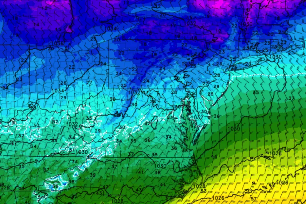
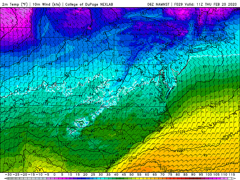
On Thursday, a storm system will pass well south of New Jersey, probably bringing accumulating snow to Virginia and North Carolina. (Hey, at least someone is getting a taste of wintry weather this year!) The latest model guidance suggests a slight northward wiggle in the storm track. Closer to New Jersey. So, I'm now thinking the entire state will be mostly cloudy (north) to overcast (south) all day. High temperatures will be in the upper 30s — definitely a cold winter day.
In addition, out of an abundance of caution, I've added a chance for snow showers to the forecast for the southern half of the state. It's important to note that we'll be right on the northern edge of this system, and our air mass will be very dry. So it's not going to do much. But I can't even guarantee no accumulation, as a quick dusting or coating is possible in far southern New Jersey, in case a stray snow band drifts our way.
By Friday, skies flip back to bright sunshine. And it will remain cold for one more day, with morning lows near 20 and afternoon highs only in the mid 30s.
And once again, after two days, our cold snap is done! (There's just no atmospheric mechanism to "lock in" the cold air mass, allowing temperatures to moderate.) Even better news, we'll keep the dry weather and sunshine for the upcoming weekend.
High temperatures should pop to around 50 degrees on Saturday, followed by lower to mid 50s on Sunday. Considering normal highs are about 10 degrees colder, that is the definition of lovely late February weather.
Our next storm system looks to come to play in the Monday-Tuesday time frame. But the exact timing is a little hazy, and so is the temperature forecast for both of those days. I can tell you that models resoundingly depict a wet and not wintry situation, yet again. And we'll eventually face another cooldown, probably toward the end of next week. (Which, by the way, is also the end of February.)
Dan Zarrow is Chief Meteorologist for Townsquare Media New Jersey. Follow him on Facebook or Twitter for the latest forecast and realtime weather updates.
More From 94.3 The Point


