
Chilly with snow squalls Wednesday, then NJ turns very cold
As North Jersey turned into an icy wonderland on Tuesday, the rest of the state endured some of the most miserably cold rain I can remember. I'm happy to share that we settle into a much quieter weather pattern through Christmas Day (one week away!) Quiet, but very cold.
Temperatures on this Wednesday morning are below-freezing for the northern half of New Jersey, along and north of Interstate 195. Watch your step, as there could be some slippery spots. (I had a layer of ice on my windshield as I left for work.)
Wednesday will start out sunny and cold, with a stiff westerly breeze up to 20 mph. High temperatures will only reach about 35 to 40 degrees, below-normal for mid-December.
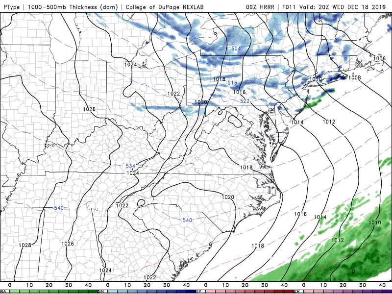
In addition, we'll be watching for a round of snow showers and snow squalls to drift down from the northeast, starting around Wednesday mid-afternoon. Accumulation is not a concern here — we could see a quick dusting or coating on cold surfaces. However, a sharp decrease in visibility could be a problem for those driving at the time.
Following a cold front passage Wednesday evening, a gusty northwesterly wind will kick up (over 30 mph). This arctic blast will lead to some ridiculously cold temperatures. Overnight, thermometers will dip into the mid teens across most of the state. (Single digits are possible in North Jersey.)
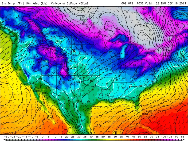
Of course, that does not tell the entire story, as we have to consider that biting wind too. The wind chill ("feels like" or "apparent" temperature) will probably bottom out between 0 and 5 degrees. Definitely time to break out the heavy winter apparel — this would be frigid even in the "dead of winter" in January or February.
Thursday daytime doesn't get much better. High temps will only reach about 25 to 30 degrees, below freezing all day. Wind chills will be stuck in the teens all day. At least it will be a bright, sunny day.
Sunshine will win out on Friday too. Still dry and still chilly, although high temperatures will be more reasonable in the mid 30s. (Still below-normal.)
To start the weekend, a storm system will drive through Georgia, way south of New Jersey. As a result, we'll see increased cloud cover from Friday night through Saturday. And there might be a few sprinkles or flurries around Saturday too. High temperatures should pop to around 40 degrees Saturday afternoon. (Several days ago, forecast models were showing this storm system would become a strong nor'easter. However, that solution has been off the table for a while, as it's digging too far south and our atmospheric flow won't be conducive to that kind of coastal storm track.)
The Winter Solstice arrives Saturday night at 11:19 p.m.
Sunday is actually looking fairly pleasant, by late December standards. Partly sunny and dry weather will meet near-normal high temperatures in the lower to mid 40s.
The slow warmup will continue into the extended forecast next week. I'm seeing upper 40s to lower 50s for Monday and Tuesday (Christmas Eve).
Unfortunately, the odds of a White Christmas this year are looking pretty low for New Jersey. If you're looking for fresh snowfall (and travel difficulties) on Eve or Day, you'll have to head to the middle of the country. A storm system progressing from the Four Corners (Colorado-New Mexico) to the Northern Plains (Dakotas-Minnesota) looks wintry. That will become our next potential storm system late next week.
Bundle up and stay warm!
Dan Zarrow is Chief Meteorologist for Townsquare Media New Jersey. Follow him on Facebook or Twitter for the latest forecast and realtime weather updates.
More From 94.3 The Point


