Fall weather to start the weekend for NJ: Cooler, breezy, showers
No More Heat and Humidity
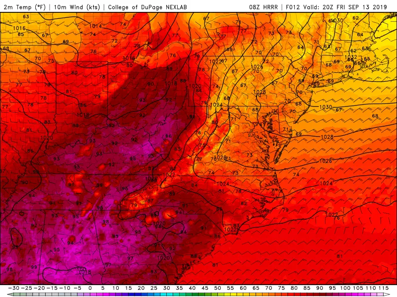
I really can't believe how warm hot it got in New Jersey on Thursday! Atlantic City International Airport in Egg Harbor Township reached 94 degrees — tying the former record set in 1961. A bust of a forecast (I predicted 86), and ACY's hottest day since July 30th.
That's all over and done with now. A cold front swept rain through the state Thursday evening, and now we're under the influence of cooler, drier air. Temperatures on this Friday morning have bottomed out in the upper 50s in North Jersey, lower 60s in Central Jersey, and mid 60s in South Jersey.
High temperatures Friday afternoon will be limited to the upper 60s to around 70. A full 20 degrees cooler than Thursday, and about 10 degrees below normal. It's going to feel more like mid-October than mid-September.
Friday's weather will be dominated by a brisk northeast-to-east wind, gusting over 20 mph along the Jersey Shore. So it's going to be a cooler and breezy day. In addition, a high risk of rip currents and rough surf is posted for all NJ beaches. NWS estimates wave heights of 6 to 8 feet — wow!
Friday night will end up seasonably cool, in the upper 50s. Skies will be mostly cloudy, and you might feel a few sprinkles around after Midnight.
Saturday a Bit Iffy
A storm system passing well north of New Jersey will provide for some unsettled weather for the first half of the weekend. I am still seeing some hit-or-miss showers around the state throughout Saturday. I can't pinpoint the who-looks-wettest geography. But I believe much of NJ remains mainly or totally dry during the daytime hours. (In other words, far from a total washout.)
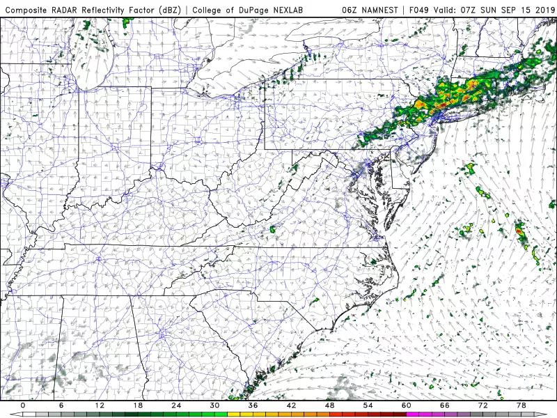
It does look like a more organized line of steadier rain will sweep through the entire state Saturday night. No biggie, although there could be some rumbles of thunder.
High temperatures on Saturday afternoon will reach the lower to mid 70s, still just a hair below seasonal norms. I'm optimistic you'll catch some glimmers of sun along the way. It's probably going to get a bit humid by the end of the day too.
Warming Up Again
There will still be some clouds and raindrops around early Sunday morning. Then clearing skies will assist in warming temperatures. Our latest forecast shows temperatures back in the lower to mid 80s by Sunday afternoon — summery again!
Monday will be warm too, with thermometers popping into the mid to upper 80s. A stiff westerly breeze will accompany increasing clouds.
Cooling Down Again
Our next cold front arrives late Monday into early Tuesday, once again opening the door for a cooldown.
That sets us up for a generally pleasant, autumnal, dry week next week I'm seeing sunny, rain-free weather with highs in the 70s for Tuesday, Wednesday, and Thursday.
One More Important Note
However, next week's forecast is highly dependent on the track of the storm currently known as Potential Tropical Cyclone #9. This cluster of showers is located over the central Bahamas, drifting toward the Florida coast. It is expected to organize into a tropical depression on Friday, potentially strengthening into a tropical storm by Saturday. The next name on the list is Humberto.
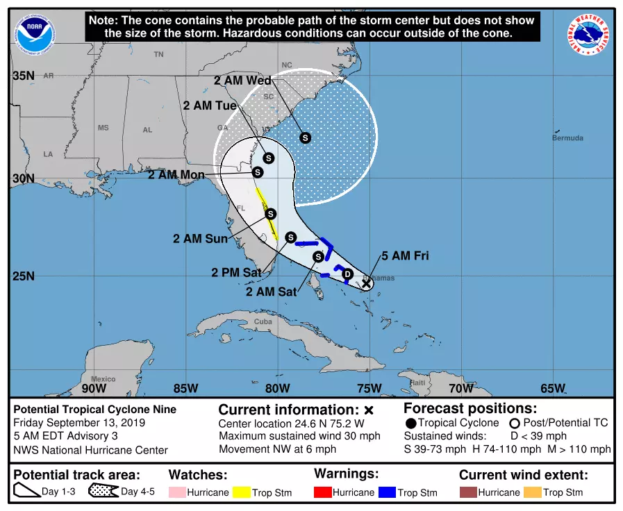
There is still a great deal of uncertainty regarding the track of this tropical system. A smattering of model runs over the past few days have shown PTC 9 coming very close to the Jersey Shore by the end of next week (about 7 days away).
There's no imminent concern. But if that "coast hugger" track holds (and that is a big "if" this far out), we'll talk more seriously about potential impacts by early next week. We'll let you know!
Dan Zarrow is Chief Meteorologist for Townsquare Media New Jersey. Follow him on Facebook or Twitter for the latest forecast and realtime weather updates.
More From 94.3 The Point