
Nasty storms for NJ Saturday: Tornado Watch until 10 p.m.
The Setup
Happy April 1st, New Jersey. 'Tis the season for showers and thunderstorms.
The ingredients are coming together for a round of nasty, noisy storms across New Jersey Saturday evening:
--Warm, moist air is blowing in - temperatures are spiking above 70 degrees, with dew points rising toward 60.
--Sunshine is cooking the atmosphere, making it highly unstable and favorable for rising air.
--A low-level jet - a river of very fast-moving air - is screaming just overhead, raising concern for strong thunderstorm gusts.
--A strong cold front will approach from the west, providing atmospheric lift.
Plenty of fuel, plenty of spark - that is a recipe for potential severe weather.
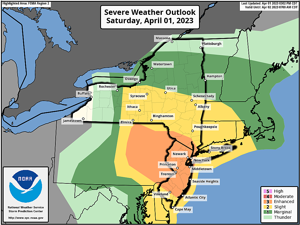
The Watches
The Storm Prediction Center and National Weather Service have issued a Tornado Watch for 16 counties in New Jersey until 10 p.m.
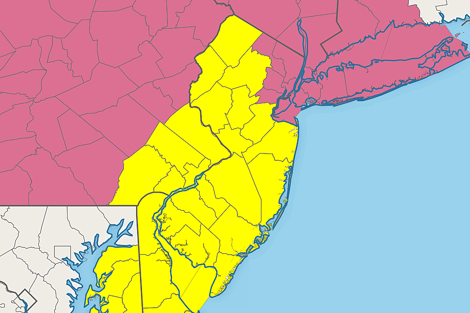
The watch includes Atlantic, Burlington, Camden, Cape May, Cumberland, Gloucester, Hunterdon, Mercer, Middlesex, Monmouth, Morris, Ocean, Salem, Somerset, Sussex, and Warren counties.
Additionally, a Severe Thunderstorm Watch covers the other five NJ counties until 10 p.m. That is for Bergen, Essex, Hudson, Passaic, and Union counties.
A "watch" serves as a formal heads-up that severe weather may occur. (Including 60+ mph winds, 1+ inch diameter hail, and/or a tornado.) It means the ingredients are there and the atmosphere is ripe to explode - but it's not necessarily a guarantee that a storm will form over your town. Nor that it will reach strong or severe limits. (FYI, the difference between the two watch types is really negligible in this situation.)
If a "warning" is issued for your area, that means a dangerous storm is imminent. That is the time to seek shelter in a sturdy building.
The Timeline
We had one round of rain and "light" thunderstorms roll through New Jersey Saturday morning. And it's hard to believe severe weather is coming, since it turned into such a gorgeous, dry, bright, warm afternoon.
But starting now, we will have to watch the western sky for storms. They will generally push eastward across NJ through about 9 or 10 p.m. Lingering showers and rumbles of thunder will be possible after then, but severe weather will be difficult as the air cools this evening.
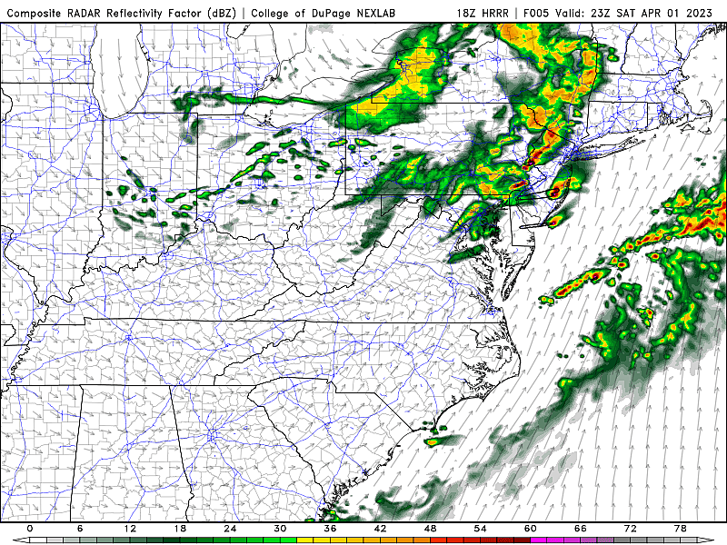
In other words, peak storm activity and intensity is expected from dinnertime through sunset.
The Threats
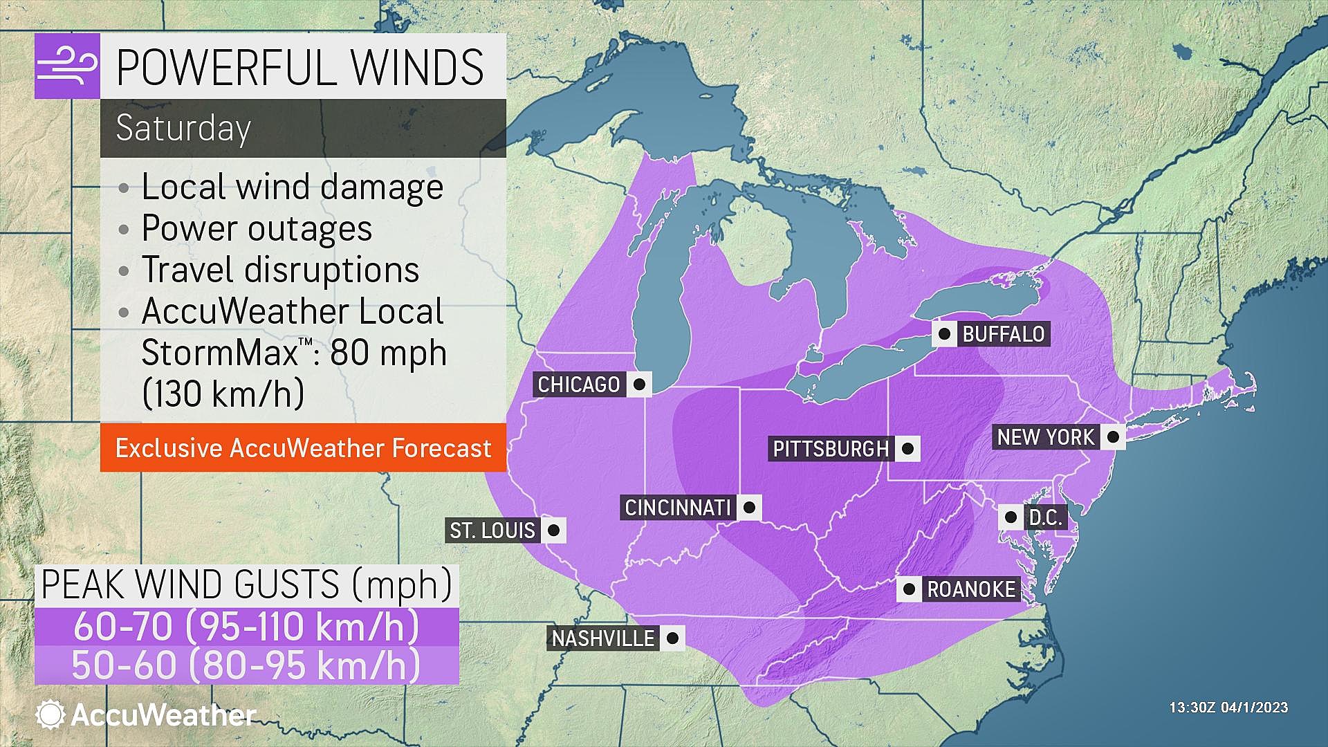
--Gusty Winds... The biggest concern. In a storm setup like this, 60+ mph wind gusts are possible, which could down trees, snarl traffic, spark power outages, and cause property damage. You will not want to be outside before or during these thunderstorms. Keep in mind also that 40+ mph non-thunderstorm wind gusts are in the forecast for the rest of today.
--Heavy Downpours... It's not a tropical storm. So multiple inches of rain and widespread flooding are not expected. But if pockets of torrential rain set up - and they probably will - there could be some visibility, traction, and localized street flooding issues.
--Lightning... By definition, every thunderstorm contains lightning. Therefore, by definition, every thunderstorm is potentially dangerous. The relative warmth building in Saturday will probably make for an electric atmosphere and an impressive light show.
--Hail... Hail are chunks of ice that fall from a thunderstorm, caused by strong updrafts (upward winds) blowing miles up into the cumulonimbus cloud. If storms are more cellular than linear, this will be a legitimate concern. Hail over the size of quarters (1" in diameter) can cause damage to roofs, windshields, etc.
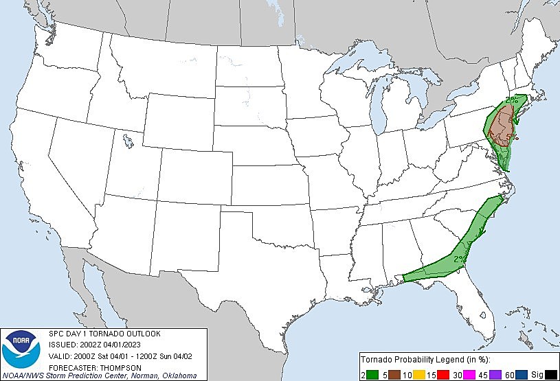
--Tornado... There is significant concern that at least one tornado forms in New Jersey during Saturday evening's severe thunderstorm episode. A tornado is a violently rotating column of air stemming from a thunderstorm - and you don't want to be anywhere nearby if one forms. The Storm Prediction Center "only" puts a 5% tornado risk over NJ - but that's actually pretty high. We will be watching very carefully for any signs of a rotating, twisting storm cell this evening.
So What?
So far Saturday, we have just sat here, watching the sky and waiting. But you will want to consider your Saturday evening plans very carefully, with a few hours of nasty, noisy weather looking likely.
It is very important to stay "weather aware" Saturday. Especially in this 5 p.m. to 9 p.m. window. And especially if you fall within either watch area.
If the sky starts to darken up and/or you can hear thunder roar, it's time to head indoors. If a Tornado Warning, Severe Thunderstorm Warning, or Flash Flood Warning is issued for your location, then you need to seek shelter immediately.
The safest place to be during a strong thunderstorm is on the lowest level of a sturdy building, away from windows.
This storm system was responsible for destructive and deadly weather across the Midwest. It is very important to take the threat seriously - yes, severe thunderstorms do happen in New Jersey too.
Our team is fully mobilized to bring you the latest information - before, during, and after the storm. We'll have Fast Traffic and Instant Weather updates every 15 minutes on your radio. And all the important details will be pushed to our mobile app too.
Stay smart and be safe out there. The sun will come out tomorrow.
Dan Zarrow is Chief Meteorologist for Townsquare Media New Jersey. Follow him on Facebook or Twitter for the latest forecast and realtime weather updates.
BEEP BEEP BEEP: These are the 13 types of Wireless Emergency Alerts auto-pushed to your phone
Gallery Credit: Dan Zarrow
11 reasons why storm chasing in NJ is a very, very bad idea
Gallery Credit: Dan Zarrow
LOOK: The most expensive weather and climate disasters in recent decades
Gallery Credit: KATELYN LEBOFF
More From 94.3 The Point


