NJ weather: More drought-busting rain, tidal flooding gets worse
The Bottom Line
We are coming off two sloppy, disgusting weather days. And in the forecast? Two or three more sloppy, disgusting weather days.
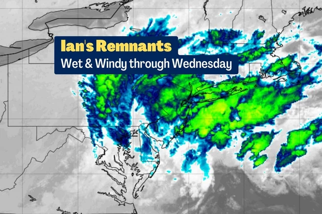
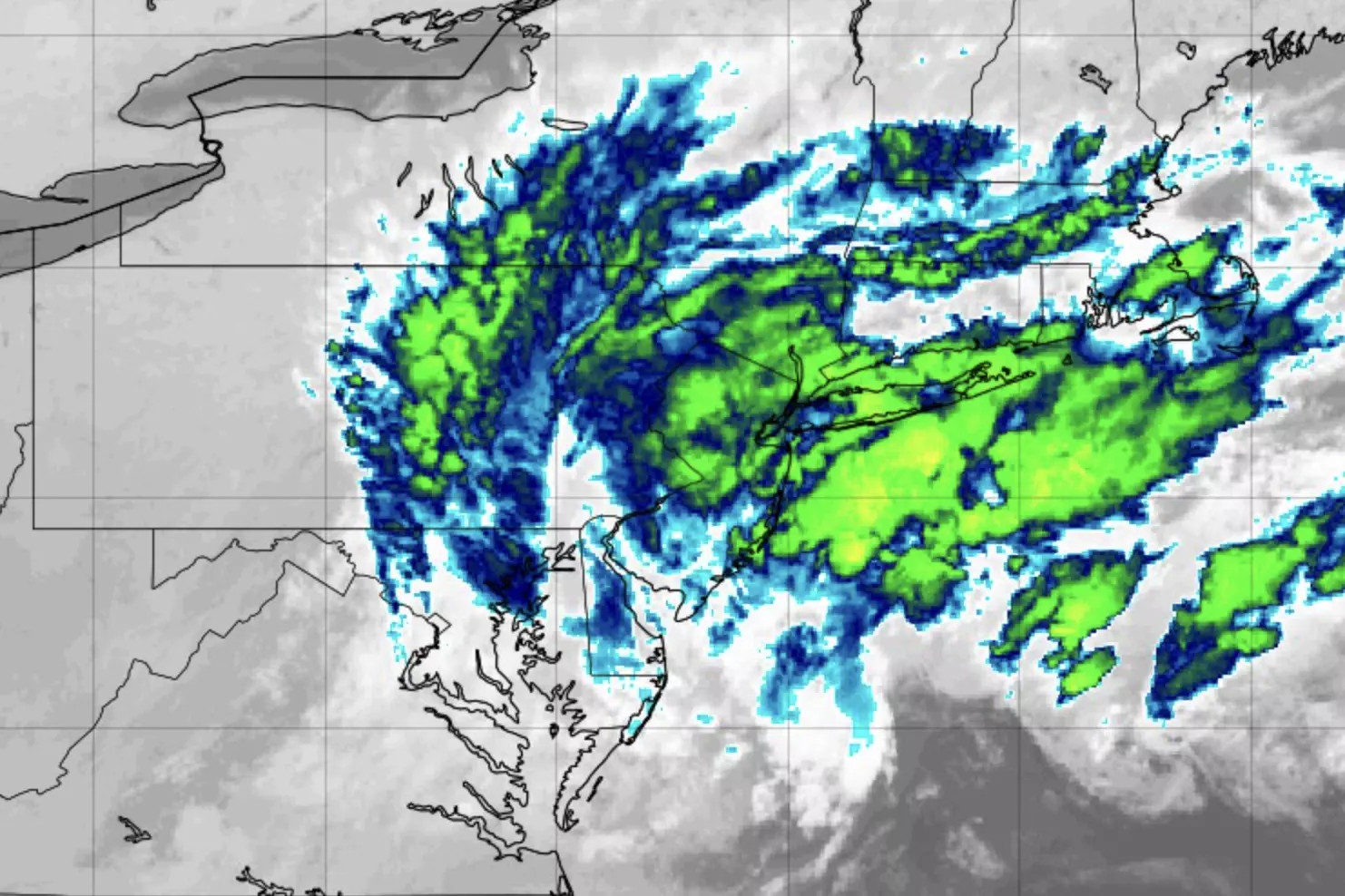
The remnant low pressure formerly known as Ian is centered just off the Virginia coast as of Monday morning. And there it will sit and spin for the next 48 to 72 hours. That's right — we are only about halfway done with Ian's "wrath" as rain, wind, clouds, miserably cool temperatures, and coastal flooding continue to plague New Jersey.
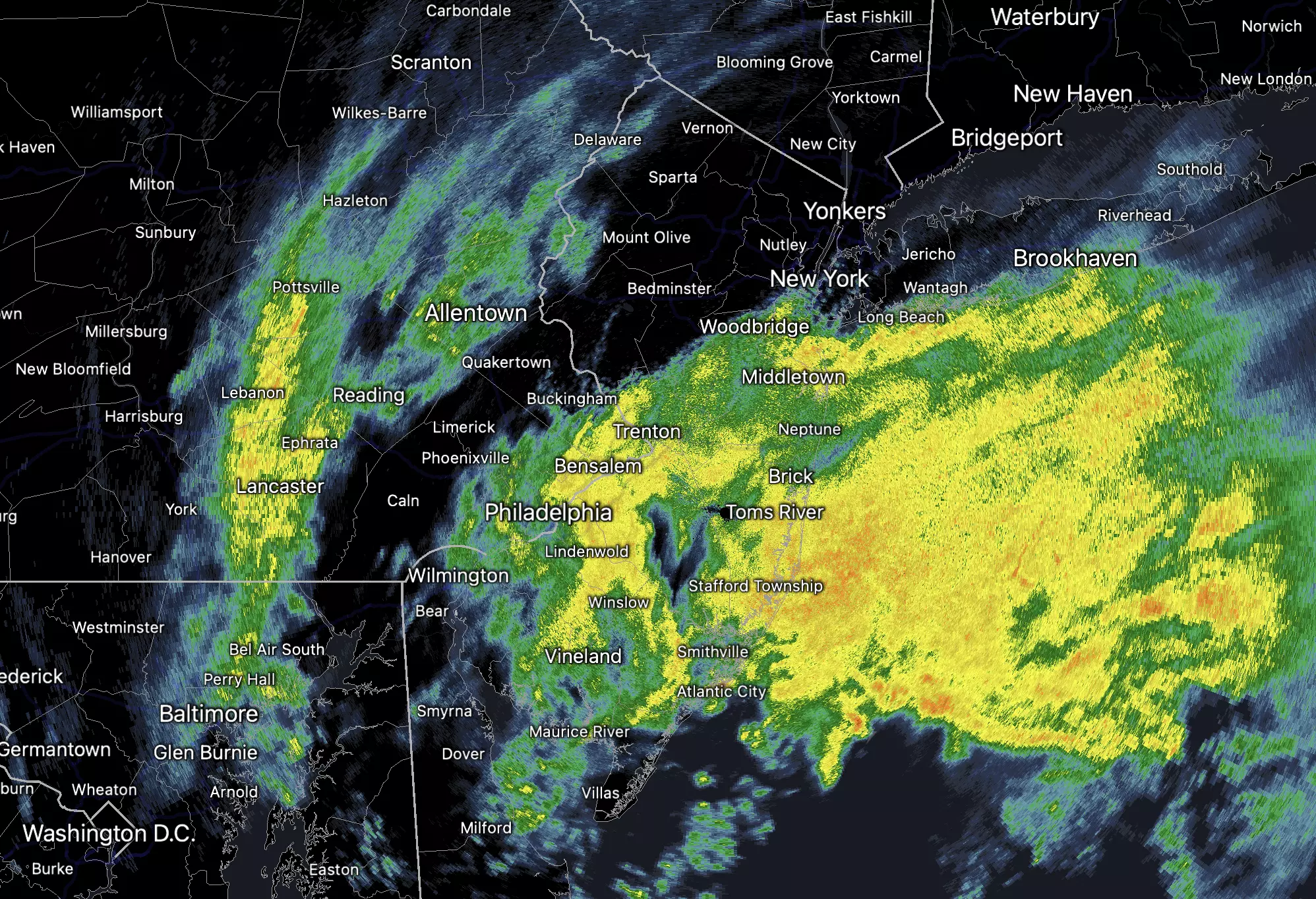
As expected, the southern coast of NJ has been the wettest in the state so far. As of early Monday morning, Atlantic City Marina surpassed 5 inches of storm total rainfall. That was also the windiest spot in the Garden State on Sunday, with a top gust of 59 mph.
An additional 1 to 3+ inches of rain seems likely before this storm system runs out of gas midweek. Winds will become less gusty than the weekend, but still very noticeable over 30 mph.
It has been a long time since New Jersey has experienced a good soak. Historically, some of our biggest and most efficient drought-busters have been extended 3 to 4 rainfall events. And that's exactly what we seeing now.
In addition to the rain and wind, we have to especially highlight the storm surge and tidal flooding threat, which peaks with Monday afternoon's high tide cycle. All that wind pushing all that ocean water. I would not be surprised to see select tidal gauges reach major flood stage.
Our weather will finally improve sometime Wednesday, as showers exit the coast. As the sun comes out Thursday, temperatures will shoot up to the spectacular 70s.
Monday
Still wet, still windy, and still miserably cool. As of this writing (6 a.m.), a solid band of moderate-heavy rain is pushing through NJ's coastal counties. It is pouring. On saturated soil, leading to some very large puddles and flooding issues to start the day.
The chance of rain continues all day Monday, although I will give two glimmers of good news:
1.) We could get some drier breaks Monday afternoon, especially across the northern half of the state.
2.) Winds will not be as gusty as this weekend. (Over 30 mph)
Overall, not a very nice first Monday of October. Temperatures will range from the 40s in the morning to the mid 50s in the afternoon. (Drier North Jersey will probably end up a few degrees warmer than waterlogged South Jersey.)
As the chance of rain rolls right along Monday night, low temperatures will dip into the chilly upper 40s on average.
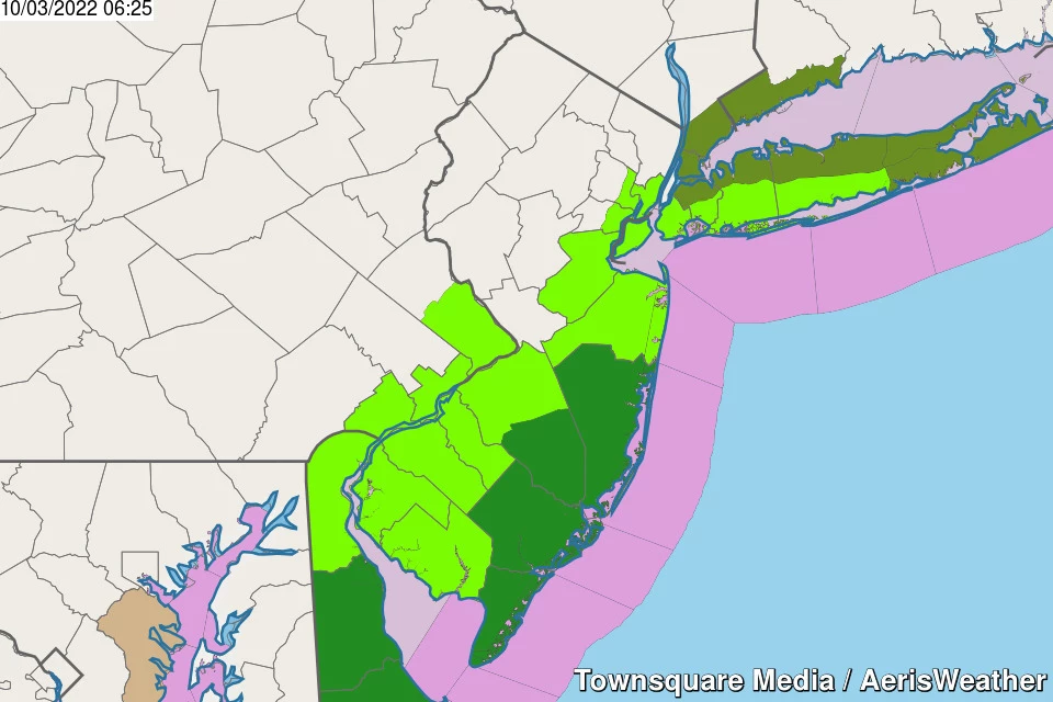
In addition to the sky, we'll have surf problems on Monday. A high risk of rip currents, with 4 to 8 foot ocean waves. And Coastal Flood Warnings and Coastal Flood Advisories are posted up and down the Jersey Shore too.
An extra 2 to 3 feet of water is expected at high tide Monday. (That will be in the early afternoon on the oceanfront, late afternoon for back bays, and early evening for the Delaware River.) That is enough to cause moderate to localized major flooding of tidal waterways. This goes beyond "the usual spots" flooding — there will be road closures and water inundation issues.
Making matters worse, the bays and lagoons will not have an opportunity to drain before our next high tide Tuesday morning. We will have several more extra-high high tide cycles in a row, with tidal flooding a big issue for coastal communities through about Wednesday.
Tuesday
It looks like we will tap into some "juicier" air on Tuesday, once again raising the risk of downpours. Given our highly saturated ground, ponding and flash flooding issues are possible. There could be some rumbles of thunder too.
Other than that, Tuesday will be another sloppy, status quo day. Wet and windy, highs only reach the lower 50s.
Wednesday
Ian's remnant low is really going to start running out of gas on Wednesday. So rainfall will become less and less prominent. And eventually, all raindrops will shift off the coast.
However, it may take all day before scattered showers fully exit the coast. Don't expect skies to clear much until very late-day. And winds will be in the "breezy" category, occasionally gusting over 20 mph.
Temperatures should respond to Wednesday's subtle improvements too, with highs popping to around 60 degrees.
Thursday
Partly sunny! Dry! With lighter winds! And warmer temperatures!
As highs push to about 70 to 75 degrees, Thursday will be a drop-dead gorgeous October day.
The Extended Forecast
Our next piece of weather news is a cold front, set to arrive Friday afternoon. Most of Friday will be beautiful again, with mostly sunny skies and highs in the lower 70s. However, as a late-day breeze kicks up, temperatures will take a little tumble Friday night. I can't rule out a few showers or sprinkles, although the frontal passage looks mainly dry.
By Saturday morning, I have to wonder if we face our first widespread frost of the season in NW NJ. The weekend will start crisp and cool, with highs on Saturday only reaching about 60 degrees. At least it will be bright and sunny.
Thermometers will recover into the more seasonable 60s through the rest of the holiday weekend. Our next chance of rain will be ... I don't know. It looks like we wil settle right back into a quiet, dry weather pattern through mid-October.
Dan Zarrow is Chief Meteorologist for Townsquare Media New Jersey. Follow him on Facebook or Twitter for the latest forecast and realtime weather updates.
11 years later — Sandy makes landfall in New Jersey
LOOK: The most expensive weather and climate disasters in recent decades
Gallery Credit: KATELYN LEBOFF
More From 94.3 The Point


