NJ turning rainy, windy, and then much colder: 6 things to know
The Bottom Line
We face several hours of steady (if not heavy) rain Friday morning. Along with elevated winds, making for some nasty (and maybe even stormy) weather.
This is the first step in a big transition, driven by a strong cold front. As the sun comes out Friday afternoon, temperatures will start to tumble.
This weekend is going to feel much more November-ish. If not December-ish, by early next week. And there will be some rain and possibly snow showers around this weekend too.
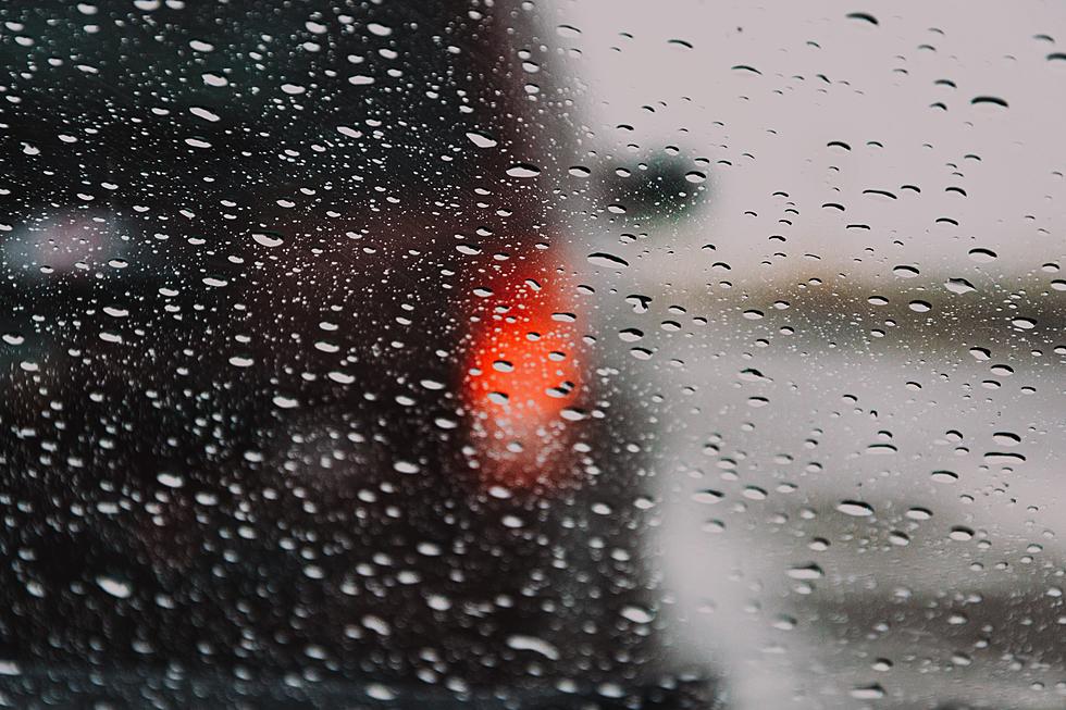
Rainy & Windy
Umbrellas up, and windshield wipers on. (Headlights on too, while we're at it, please.) As of this writing (6 a.m.), radar is filling in with sporadic showers. We're just getting starting with our period of wet weather, which will run until early Friday afternoon.
There could be some pockets of heavy rain along the way. Forecast models have decreased rainfall potential, ranging from about a quarter-inch for interior South/Central Jersey, to about an inch for North Jersey and (possibly) along the coast.
Meanwhile, the wind will kick up alongside the raindrops. Sustained winds of about 20 mph, with gusts to 30-40 mph are expected.
In other words, a fairly wet, windy, nasty morning. The peak ("brunt") of the storm will be the late morning hours.
Thunderstorm Potential
Some of my meteorological brethren have been heavily promoting the potential for severe weather and flooding from this storm system. And I just don't see it.
Could we see some stronger thunderstorm cells roll through the state? Especially as the front itself pushes closer around Friday late morning? Absolutely. Heavier downpours, gusty winds, and even some hail are possible. (Especially since our air is warm and humid, which will help to fuel those storms.)
Could we see some ponding ("big puddles") during bands of heavier rain? Sure. But our ground is pretty dry, so it will "drink up" and soak up a lot of that rainfall the instant it falls. Widespread flooding issues seem unlikely.
Again, rainy and windy. That is my best description for Friday morning's weather.
When Will We Dry Out?
Midday. Lunchtime. I expect rain and thunderstorms to end, from west to east, between about Noon and 2 p.m.
Skies may become bright and sunny within an hour later, as drier air arrives Friday afternoon.
The Initial Cooldown
One phrase I use often during the winter months is "arctic blast" — the sudden arrival of cold, dry air that causes temperatures to rapidly crash. This front is not one of those, as we take a couple of steps downward through the weekend. But the end result will be the same — unseasonably chilly temperatures.
As our new, cooler, drier air mass arrives Friday afternoon, temperatures will descend from the 60s into the 50s. Continued breezy conditions will remind you it's cool.
Overnight temperature also won't crash. Models suggest mid 40s, on average, across the state by Saturday morning. Some 30s and patchy frost is possible in the colder northwest corner of NJ.
Saturday's high temps will range from the lower 50s (north) to mid 50s (central) to near 60 (south coast). Fairly typical for mid-November.
Additional Weekend Showers
You may have to dodge two batches of raindrops over the weekend too.
The first will be a quick smattering of scattered rain Saturday early afternoon. 2 to 3 hours, tops. Only a big deal if you outdoor plans.
Another weak wave will clip NJ's atmosphere Sunday evening through early Monday morning. What we will see fall from the sky largely depends upon which model you believe. I'm still thinking it will be mostly raindrops — and light ones at that. But there could be some snowflakes mixed in across New Jersey. Don't blink or you might miss them — no accumulation or travel issues are expected.
From November-ish to December-ish
You may be reaching for the heavier coat starting on Sunday. A widespread morning frost/freeze is likely. Followed by high temperatures only around 50 degrees.
Thermometers may be stuck in the 40s at best for Monday and Tuesday, before we get a break in the chill around the middle of next week.
Dan Zarrow is Chief Meteorologist for Townsquare Media New Jersey. Follow him on Facebook or Twitter for the latest forecast and realtime weather updates.
BEEP BEEP BEEP: These are the 13 types of Wireless Emergency Alerts auto-pushed to your phone
Gallery Credit: Dan Zarrow
Every Governor New Jersey has ever had
Gallery Credit: Joe Votruba
More From 94.3 The Point


