Update: Tornado Watch issued for most of NJ until 6 p.m. Monday
As of this writing (Noon), the first phase of Monday's storm is complete. Heavy rain drenched most of New Jersey, with most rainfall totals ending up between 1 and 2 inches.
We are diving into Monday early afternoon with the strongest wind gusts of the day — 50+ mph inland, 60+ mph along the coast. In addition, the atmosphere is set to explode even more with a round of scattered strong to severe thunderstorms too.
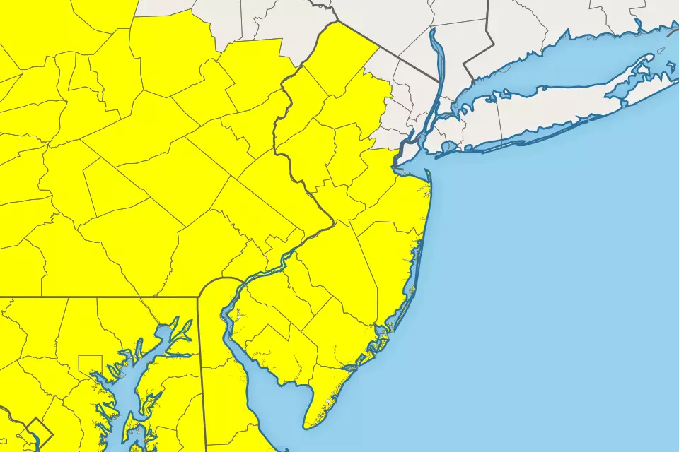
The National Weather Service has issued a Tornado Watch for most of New Jersey, in effect until 6 p.m. Monday evening. A watch serves as a formal heads-up to potentially dangerous weather conditions — including damaging winds, hail, and yes even a tornado. It does not guarantee bad weather will come to visit your town, just that the atmosphere is ripe with sufficient moisture, instability (energy), and lift this afternoon. You should be prepared to take shelter in a sturdy building in case a warning is issued.
The watch covers the following 16 counties: Atlantic, Burlington, Camden, Cape May, Cumberland, Gloucester, Hunterdon, Mercer, Middlesex, Monmouth, Morris, Ocean, Salem, Somerset, Sussex, and Warren.
So far the forecast remains on track. Here's a rough timeline for the rest of the day...
—Through about 2 p.m... strong background winds will continue blowing through the Garden State through about 2 p.m.
—Between about 2 p.m. and 6 p.m... Then strong to severe thunderstorms will sweep from west to east between about 2 p.m. and 6 p.m.
—After 6 p.m... conditions will improve dramatically, as skies clear out and winds calm Monday evening.
For more on the timing and impacts of this stormy day, I recommend reviewing my Monday morning weather blog post:
And be sure to download our app to stay up to date with all the storm alerts, power outages, road closures, and more:
Stay smart and be safe out there!
Dan Zarrow is Chief Meteorologist for Townsquare Media New Jersey. Follow him on Facebook or Twitter for the latest forecast and realtime weather updates.
More From 94.3 The Point